Table of Contents
Let me tell you about the hunt that made me believe in map research using Sanborn fire insurance maps for metal detecting. It wasn’t luck. It was a method. It started with a grumpy old-timer at a club meeting and ended with a cluster of Barber dimes in a spot everyone else had missed. This guide will show you how to use these maps for metal detecting.
Most urban detecting is swinging in random parks, hoping for a modern drop. You might get lucky. But what if you could hunt places where history is guaranteed to be under your coil? This guide will teach you how. We’ll cover accessing Sanborn maps—those detailed fire insurance records for over 12,000 towns. We’ll decode their symbols, overlay them on modern views, and, most importantly, turn that paper trail into a legal, productive hunt.
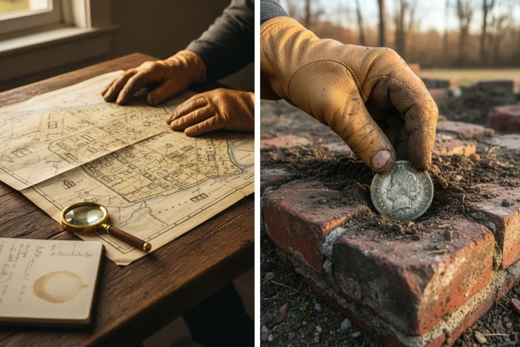
My own lightbulb moment came after an old club member mumbled about the “old trolley stop” near the river. I chased that lead to the library. I pulled a 1905 Sanborn map and found a tiny, marked waiting area. It’s now just a scrubby patch of city-owned land. My first signal there was a 1904 Barber dime. The next five holes held three more. It wasn’t a fluke. It was archaeology. The map told me people had to be there, waiting, fumbling for change.
This guide is that process, step-by-step. We’ll start with finding the maps (it’s easier than you think). We’ll learn to read their colorful language. And most importantly, we’ll learn how to go from a historical footprint to a filled pouch. Let’s get started.
What Are Sanborn Maps and Where to Find Them (It’s Easier Than You Think)

Think of a Sanborn map as a Google Street View for a time traveler. They were made between 1867 and 1977 for fire insurance companies. These large-scale maps documented the construction materials, footprints, and even business types of buildings. For us, they’re a direct blueprint to lost social spaces. This is where people lived, worked, and inevitably, lost things.
First, a crucial caveat. These maps aren’t neutral historical records. As preservationists note, Sanborn surveyors often left out poorer or minority neighborhoods. The insurance company didn’t care about them. If an area isn’t on the map, it doesn’t mean nothing was there. It just means they didn’t map it. This bias affects where we look.
Finding them is straightforward. Start here, in this order:
- The Library of Congress Online (Free): This is your first stop. Their digital collection is massive and free. You can often find your town and browse by year.
- Your State’s Digital Archive (Also Free): Many state libraries and universities have digitized their collections. A quick “[Your State] digital Sanborn maps” search works wonders.
- Local Historical Societies (May require a visit): For hyper-local detail, nothing beats the physical volumes sometimes held in a town’s historical society. This is where I found the correction slip showing the exact month a livery stable was added.
A quick pro-tip from the archives: watch for address numbering changes, especially in the 1890s. A building’s number can shift between editions. Always cross-reference with a known landmark.
With roughly 50,000 maps across 700,000 sheets, the chances your town is covered are excellent. My buddy Mike thought this was a scholar’s game. Then I pulled the maps up on my phone at the park. It’s that easy now.
(For a great primer on starting your first map-based hunt, check our existing Sanborn Maps Metal Detecting Guide for more starter tips.)
Cracking the Code: Colors, Symbols, and What They Mean for Your Detector
Here’s the quick decoder. Sanborn maps use a color-coded shorthand. Pink/Red is brick, Yellow is wood frame, and Blue is concrete or stone. The abbreviations tell you what happened there: D (dwelling), Sal (saloon), S (store), F (factory). Your job is to translate these into places where people lived, worked, fumbled in pockets, and lost things. This isn’t just cartography—it’s a treasure-hunting legend.
I learned this the hard way. For years, I skimmed over a small, circular symbol labeled “Cistern” on a map. It just looked like a water source to me. My buddy Tom, who’s more patient, didn’t ignore it. He researched it and got permission for the modern property. In that filled-in cistern—a historic trash pit—he pulled 15 V-nickels, a handful of Barber dimes, and a stack of late-1800s buttons. The map had literally circled the hotspot.

Here’s your essential legend for turning symbols into sites:
- Colors (Building Material):
- Yellow: Wood Frame. Common, but decays. Focus on the footprint where the porch or steps were.
- Pink/Red: Brick. Lasts. The foundation or rubble might still be in the ground.
- Blue/Gray: Stone, Concrete, or “fireproof.” Often public or industrial buildings.
-
Abbreviations (Building Use – This is the gold):
- D (Dwelling) + small rear outbuilding: That’s your outhouse/trash pit. Prime digging.
- Sal (Saloon): A prime target. Dropped coins, tokens, watch fobs.
- S (Store): Check for a front step or boardwalk area where customers entered.
- F (Factory) or Mill: Look for worker entrances, lunch yards, or trolley stops nearby.
- Gar, Livery, Stable: Horse traffic means lost hardware, harness decorations, and coins.
Don’t just look for buildings. Look for the activity zones around them. A “Sal” is good, but the hitching post out front and the path to the privy out back are often better. The map gives you the stage. Your detector finds the lost props. This is the core of using Sanborn fire insurance maps for metal detecting.
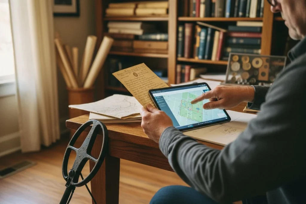
From Paper to GPS: The Simple Guide to Georeferencing (No PhD Required)

Georeferencing is a fancy word for lining up your old map with a modern satellite view. You match permanent points. These points are street intersections, church corners, or railroad bends. You match them between the old sheet and today’s landscape. This bridges the 100-year gap. It shows you exactly where to swing your coil. It sounds complex, but you can start with zero special software.
Let’s break it down into three simple tiers, from easiest to most precise.
Tier 1: The Eyeball Method. This is how I started. Print your Sanborn map section. Open Google Maps or Google Earth on a tablet. Find a clear, unchanged landmark on both. A major street intersection anchored by a church that’s still there is perfect. Manually align them by sight. This works surprisingly well for small areas. I’ve found many a backyard privy site with just this method, a printer, and a highlighter.
Tier 2: Digital Overlay (The Sweet Spot). This is my go-to for most projects. Use a free online tool like MapWarper or even a simple trick in PowerPoint. The process is the same. You upload the Sanborn map image and “pin” known points to their modern GPS coordinates. Start with at least three widely-spaced points. The software then stretches the old image to fit the modern base map. A quick tip: Later maps (1950s and onward) often have an excellent guide to symbols and scales right inside the front cover. Yes, the old map will distort. But the software “rubber sheets” it into place. It’s not perfect, but it gets you within a few feet. That’s all you need.
Tier 3: The Pro-Tier (Briefly). If you get deep into this, free software like QGIS is the ultimate tool. The learning curve is steeper, but it’s incredibly powerful. For 95% of detectorists, Tier 2 is more than sufficient.
The core concept is matching the permanent to the permanent. Once aligned, that forgotten Sal (saloon) symbol is no longer just on a page. It’s pinned right over that modern parking lot or vacant lot. That’s when the real hunt begins.
(Stuck on a tricky alignment? For deep technical help, our forum community is great for troubleshooting specific map issues.)
Reading Between the Lines: How to Spot a Detecting Goldmine
Here’s the counterintuitive truth. The empty lot on the map is often better than the mansion. Your goal isn’t the grandest structure. It’s finding where daily life spilled out. These are places where people fumbled in pockets, gathered, and tossed trash. I look for where people lived, worked, and played. The map’s real treasure isn’t the buildings. It’s the negative space and activity zones around them.
Start by analyzing a full block. First, identify Transition Zones. Where a yellow (wood-frame) neighborhood meets a red (commercial) street, you have a mixing point. Residents walking to the store, workers heading home—this is a drop zone. My first Barber quarter came from a grassy strip that was once this boundary.
Next, pinpoint Community Hubs. A `Sal` (saloon), a corner `S` (store), or a streetcar stop are magnets for lost items. Don’t just mark the building. Target the approach. The three steps up to the saloon door and the wooden boardwalk out front are prime territory.
Now, look for The “Back 40”. Behind every `D` (dwelling), scout for a small, separate outbuilding. That’s the outhouse or trash pit. These are time capsules. As the maps show property boundaries and house numbers clearly, you can often match a historic lot to a modern backyard. A filled-in cistern symbol is a guaranteed dig spot.
Don’t ignore Alleys and Footpaths. These service lanes were where ash bins were kept. This is also where kids cut through. A dotted line for a footpath often becomes a modern right-of-way.
Finally, play spot-the-difference between map editions. Look for Changed Landscapes. A blue line for a creek in 1895 that’s gone by 1915 means a filled area. A solid block of buildings replaced by an empty lot means churned fill. That “empty” lot is usually anything but.
The Critical Bridge: From Map Point to Legal Permission
You’ve found the perfect spot on the map—a 1910 general store with a wooden boardwalk. Now comes the real test: getting permission to dig. This is where your Sanborn fire insurance maps transform. They become your most powerful advocacy piece. They prove you’re a historian, not a hoard hunter.
I once knocked on a door in an old Sacramento suburb with a printout in hand. The homeowner was skeptical. Then I showed him his own backyard on the 1912 sheet. “See this symbol? That was a general store. People gathered here.” His skepticism melted into fascination. That conversation, backed by the map, granted me access. It yielded three Barber dimes and a handful of early 1900s tokens. The map built trust before I ever swung a coil.
Your approach script is simple: “Hi, I’m [Your Name]. I’ve been researching this neighborhood’s history using old insurance maps. I believe your property was once part of [describe the site]. I’m a detectorist who focuses on recovering these little pieces of local history. Would you be open to me scanning your yard? I’m fully insured, fill every hole, and I’d share anything I find with you.” The map is your credential.
For public land, the map informs a different question. At a city parks department, it helps you ask specific questions: “I’ve identified this area as a former streetcar stop from 1905. Are there any ordinances I should know about?” This shows due diligence.
Remember, a Sanborn map can be cross-referenced with old city directories. This adds another layer to your research. If you hit a dead end with a current owner, this historical deed research can sometimes reveal a more interested heir.
Ultimately, the map does the heavy lifting. It turns a vague request into a specific historical proposal. It’s the critical, ethical bridge between finding a site and respectfully uncovering its stories. Using Sanborn fire insurance maps for metal detecting makes this process possible.
In the Field: Hunting Your Researched Site and Interpreting Finds

Answer Capsule: When you finally hunt a site from your maps, the real work begins. Use a grid pattern starting at your “hot spot.” The magic happens after the hunt. Cross-referencing each find with its location on the map transforms artifacts into pieces of someone’s history.
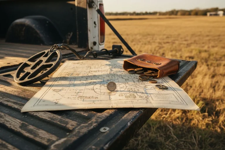
I’ll never forget my first gridded hunt at that old train stop. My map showed the platform, the baggage shed, and a waiting area. I started at the platform steps. Then I laid out a mental grid over the entire area and worked it methodically. I kept every find from each grid zone in a separate bag.
Afterwards, with the map on my tailgate, the story emerged. The 1905 Barber dime came from the grid square over the platform’s edge. It was likely dropped by a passenger. Two wheat pennies and a harmonica reed clustered near the baggage shed symbol. That’s when a cluster of artifacts becomes a narrative.
This is your goal. That toy car near the “D” with an outbuilding? A child’s lost treasure. That ornate button in the alley behind the “Sal”? Perhaps lost in a scuffle. Your finds are no longer isolated objects. They are data points on a historical map. (My kids love this part—it’s like detective work.)
So remember: grid the site, keep finds organized by zone, and always, always fill your holes perfectly. The legacy you leave is just as important as the history you uncover.
Now, I want to hear from you. Have you connected a find directly to a Sanborn map symbol? Share your story in the comments below.
Sanborn Maps FAQ: Answering Your Top 5 Questions
Got questions? I’ve heard plenty. Here are quick answers to the ones that come up most often.
1. Are there Sanborn maps for my small town?
Probably, if your town had over 1,000 people during the mapping era (1867-1977). Sanborn aimed to cover every established community. A key limitation is that surveyors focused on built-up commercial areas, sometimes ignoring poorer or minority neighborhoods. Your first stop should still be the Library of Congress.
2. The online map scan is blurry or low-resolution. What can I do?
Don’t give up. The Library of Congress scans vary in quality. Many states have their own higher-resolution digital archives. Also, contact your local historical society or a major university library. They often hold crisp, original volumes.
3. How do I handle different years or editions for the same area?
Look for the updates! Sanborn employees would paste physical “correction slips” over outdated parts. These slips show new buildings or altered streets. When comparing digital sheets, these pasted-on slips are your guide to what changed. They turn a map into a timeline.
4. This feels complicated. Is it really worth the effort?
Absolutely. I’ll level with you: random park hunts are a lottery. Research turns it into a calculated search. Spending an hour with a Sanborn fire insurance map for metal detecting to find a 1920s picnic grove is the difference between hoping and knowing history is under your coil. It transforms the hobby.
5. Can I use these maps for public park detecting?
100%. Parks are goldmines on these maps. Look for symbols for old park layouts, pavilions, bandstands, and picnic areas. These were the exact spots where crowds gathered a century ago. It gives you a targeted plan instead of wandering. This is a key tactic for Sanborn fire insurance maps metal detecting.
Your Next Hunt Starts in 1902: Putting It All Together
Answer Capsule: Using Sanborn fire insurance maps for metal detecting changes the hobby from a lottery into a historical investigation. The process turns anonymous land into a story waiting for its final chapter. Your best tool isn’t the detector in your hand; it’s the historical record.
For me, this was the shift that changed everything. No more just hoping a park yields something old. Now, I know a 1910 picnic grove was there, or a trolley stop existed on that vacant lot. The history is guaranteed. You just have to methodically listen for it.
So here’s your push. Open the Library of Congress Sanborn collection. Find your neighborhood. Look for what’s not there anymore. The empty square where a general store stood. The grassy strip that was a busy streetcar line. That’s where you’re hunting next weekend.
Then, come tell us what you found. Leave a comment below or head to our community forum. We’re all detectives piecing this history back together, one find at a time. Just remember to fill every hole and leave the story intact for the next researcher. Happy—and informed—hunting.

My name is Paul and I am the founder of Detector For Metal, a dedicated resource for metal detecting enthusiasts seeking to uncover historical treasures and connect with the past using the latest technology. As a stay-at-home dad and family man, I’ve found metal detecting to be the perfect hobby that combines family adventure with historical learnings for the whole family.
As a father, I’m deeply committed to passing on this hobby to the next generation of detectorists, starting with my own children. I share advice on everything from metal detecting with kids to exploring the top 10 metal detecting sites you never thought about. My methodical approach to the hobby goes beyond the thrill of discovery—it’s about creating family traditions while preserving history and sharing the stories of those who came before us.