Table of Contents
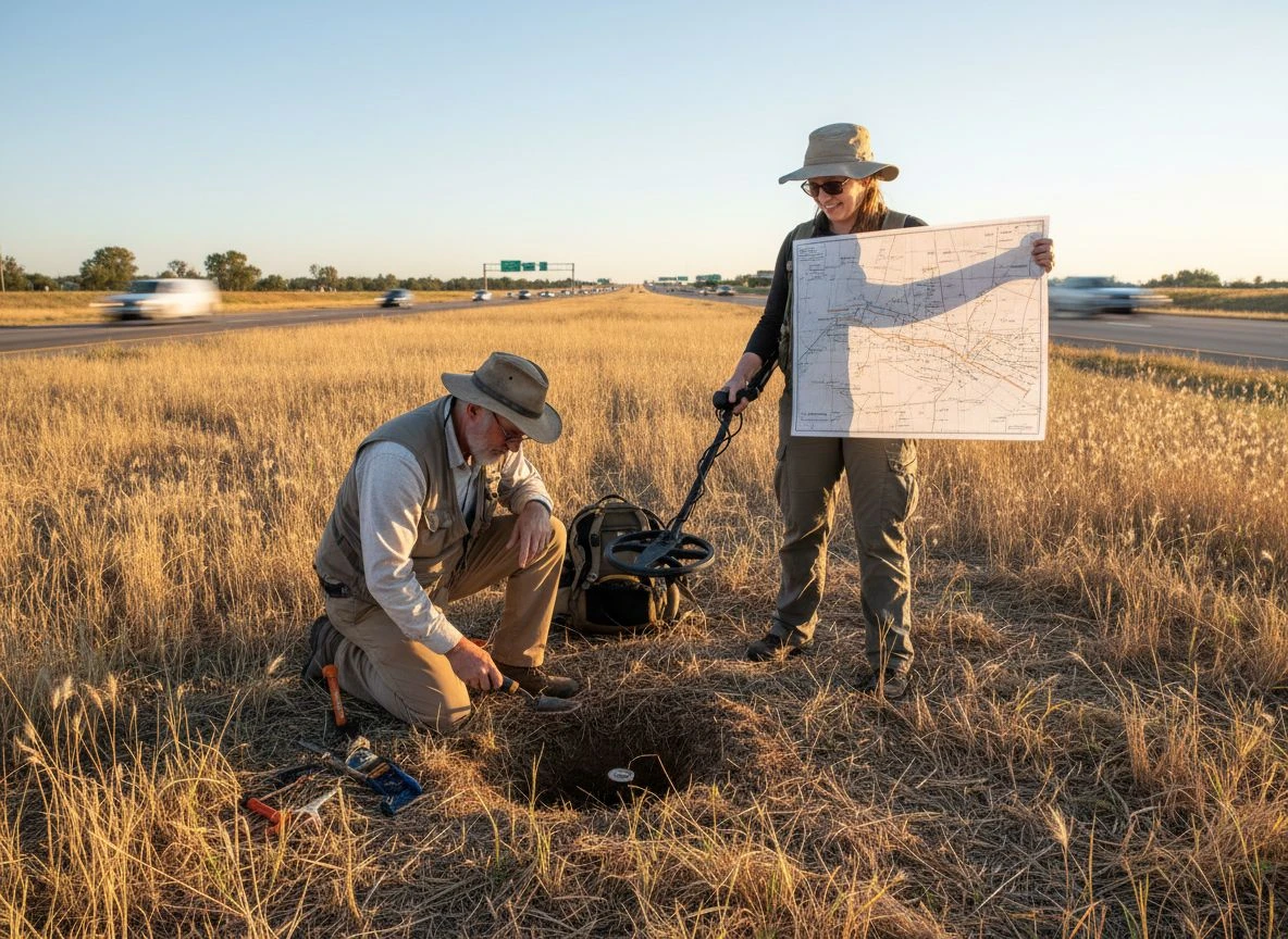
My buddy Tom was laughing at me. We stood in a grassy median between two lanes of a modern highway. “You drove us an hour to hunt a road divider?” he asked, shaking his head. My Minelab Equinox 900 was silent. I was starting to sweat. All I had was a crumpled printout of a Sanborn Fire Insurance Map from 1912, but my faith in Sanborn maps metal detecting was about to be tested. It showed a bustling streetcar stop, a confectionery shop, and a boarding house right where we stood. Now, it was just grass and asphalt.
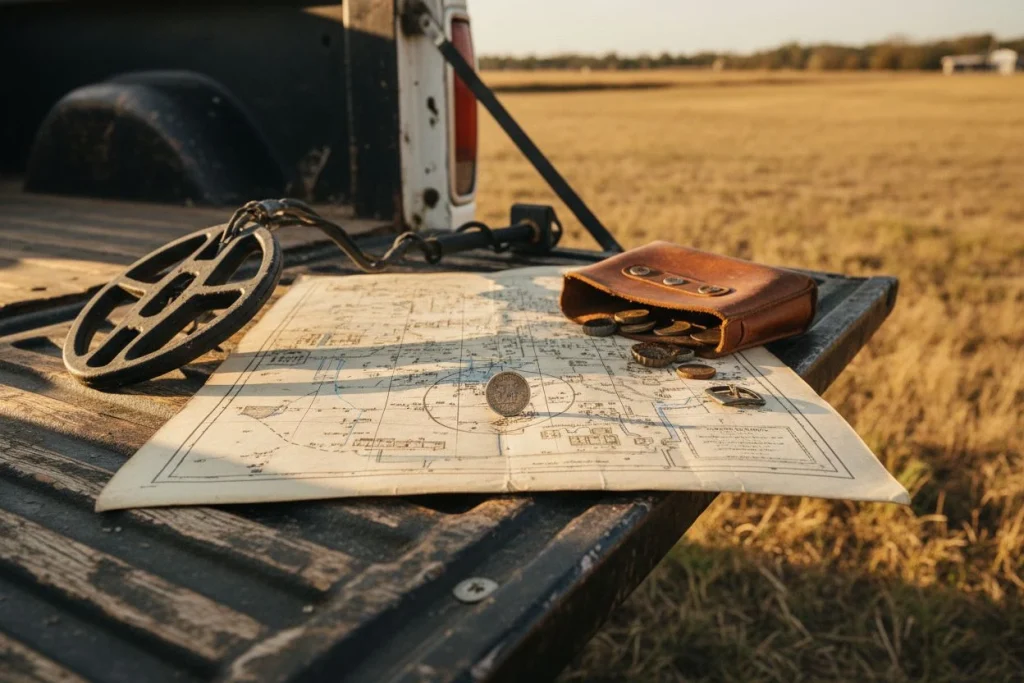
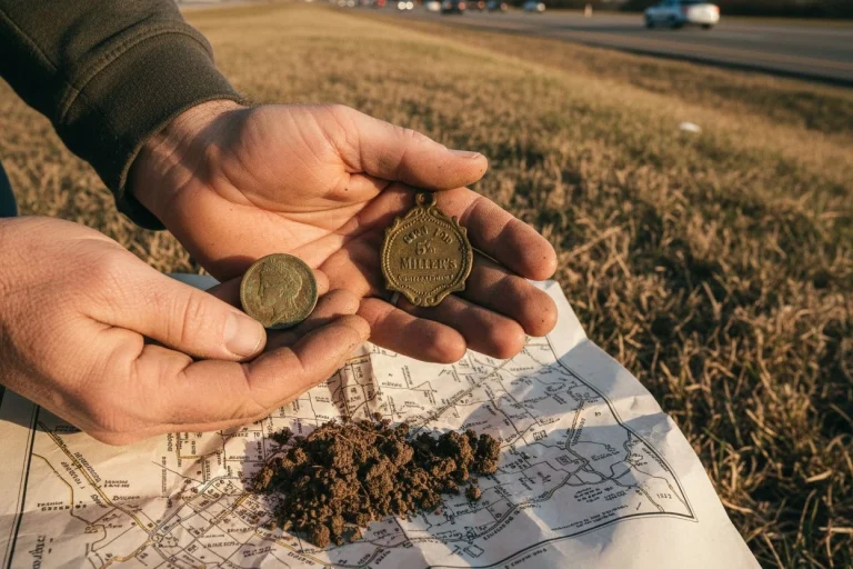
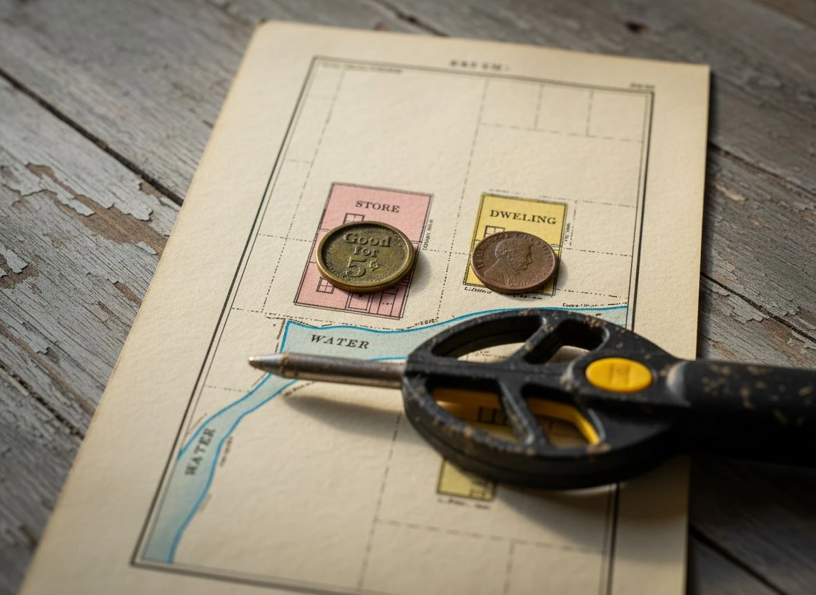
Then my detector gave a solid, high-toned signal. Eight inches down, I pulled out a 1903 Barber dime. It was crusted with patina but perfectly detailed. Two feet away, Tom’s machine screamed. He unearthed a heavy, ornate brass token. It was stamped “Good for 5¢ at Miller’s Confectionery.” We spent the next three hours pulling Indian Head pennies, a worn Mercury dime, and my first-ever Seated Liberty quarter. Tom stopped laughing. He started asking how to get his own copies of those maps.
That’s the magic of Sanborn maps metal detecting. They’re not just old drawings. They’re a time machine. They let you see exactly where people lived, worked, and lost things decades before you were born. I’m probably way more excited about these things than any normal person should be. (My wife says I collect obscure facts like some people collect stamps.) But if you want to move beyond random park hunts, you need an advantage. Learning to read these maps is that advantage.
Why Sanborn Maps Metal Detecting is a Game-Changer
Let’s start with the basics of Sanborn maps metal detecting. From the 1860s to the mid-1900s, the Sanborn Map Company held a near-monopoly on creating detailed fire insurance maps. Daniel Alfred Sanborn founded it. The company’s goal was simple: let insurance underwriters assess fire risk without visiting every property in person. They made large-scale plans that documented the exact built environment of thousands of towns and cities.
For us, that’s pure gold. A historical photo shows you a building’s facade. A Sanborn map shows you its footprint, what it was made of, its outbuildings, and even where the water hydrants were. As the Library of Congress notes, these maps combine the utility of photos, directories, and bird’s-eye views into one resource. They tell you not just what was there, but what it was made of and how it was used. That candy shop on my 1912 map? That’s why we found so many coins, and it’s a perfect example of the power of Sanborn maps metal detecting.
The last new Sanborn map was made around 1961. That means their coverage is perfect for our sweet spot: the late 1800s through the early 1950s. These maps are the ultimate research weapon. A $200 detector at a site you’ve pinpointed on a Sanborn map will always beat a $1,500 detector. This is true even at a random, unresearched spot.
How to Read Sanborn Maps for Metal Detecting: Decoding Symbols
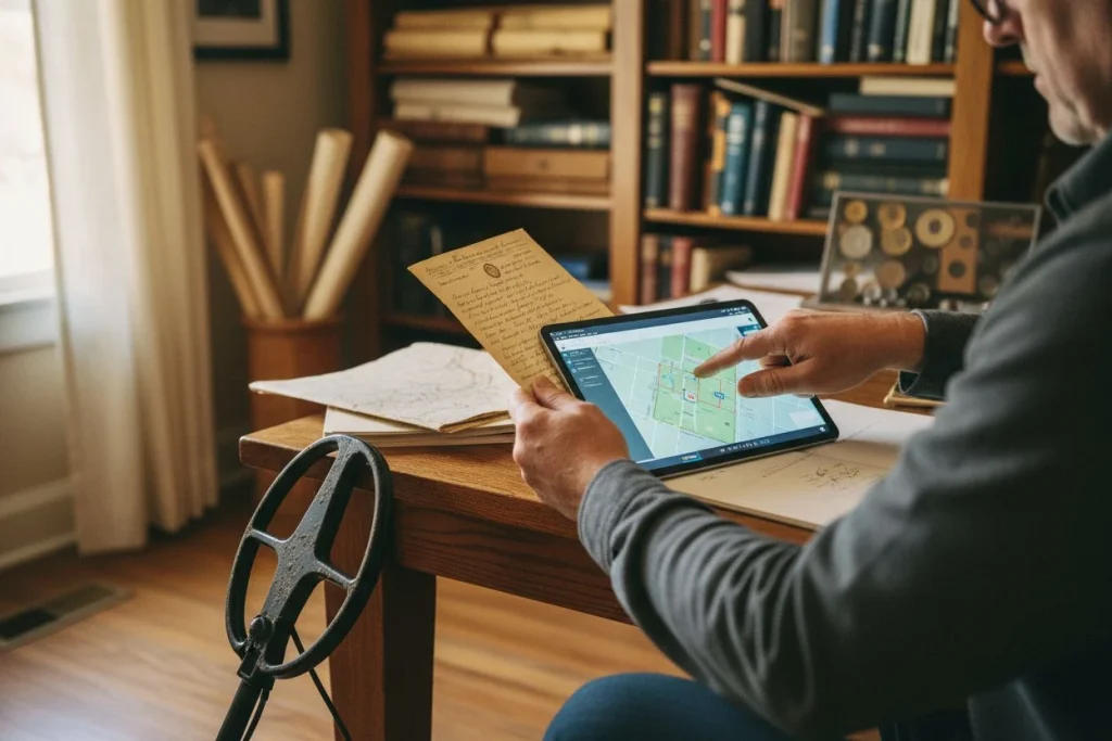
Your Sanborn maps metal detecting journey starts at the digital doors of the Library of Congress. It holds the world’s largest collection. Due to copyright, most free online maps are from before 1922. That’s perfect for our purposes. Don’t get overwhelmed. The first and most important step is one most beginners skip: find the index sheet.
Every Sanborn volume for metal detecting begins with a master index or “key map.” This is your non-negotiable starting point. As the guide from the South Carolina State Historic Preservation Office emphasizes, this index provides the context for all the symbols and codes. The index shows how the town was divided into smaller, numbered sheets. Find your modern area of interest on a current map. Then use this index to figure out which specific Sanborn sheet you need.
Once you have your Sanborn map for metal detecting, you need to speak its language. The maps use a standardized color-coding and symbol system. Here’s your quick detectorist’s decoder ring:
- Yellow: Wood-frame construction. Common for houses, sheds, and small shops. Expect nails, hardware, and maybe older coins if it’s a home.
- Pink/Red: Brick or tile construction. Often used for larger businesses, factories, or nicer homes. These sites can be rich in industrial artifacts and tokens.
- Blue: Stone or concrete. Think foundations, banks, or city buildings.
- Small Numbers Inside a Footprint: The number of stories. A “3” in a factory footprint means three floors of workers potentially losing items.
- Circles/Dots on Roofs: Indicate the roofing material (like slate or tin). This matters less for detecting, but shows the care put into the map.
Look for the legend on your specific sheet. It will have a detailed symbol key. Print it out. Stick it on your wall. This is your Rosetta Stone.
Translating Historic Addresses for Sanborn Maps Metal Detecting

Here’s where the real work of Sanborn maps metal detecting begins—and the biggest headache. The address on a 1905 map is almost certainly not the same address today. Streets get renamed, renumbered, and sometimes erased entirely.
My first major fail came from ignoring this. I found a beautiful 1897 map showing “The Oaks Saloon” at 212 Elm Street. I drove to modern 212 Elm and detected a perfectly manicured lawn from the 1970s. Nothing. After digging (metaphorically) at the city archives, I learned the truth. The entire street was renumbered in 1910. The 1897 “212 Elm” was under what is now a paved parking lot behind 502 Elm. I’d been detecting in the wrong spot for weeks.
The solution? You need a conversion key. City Directories are your best friend here. These annual publications listed residents and businesses by address. Compare directories from before and after a known renumbering date. You can track a business like “Miller’s Confectionery” as its address changes from an old number to a new one. Local historical societies often have guides for these changes. The New Orleans City Archives guide specifically warns researchers about these major shifts.
Your Action Plan:
- Identify your target on the Sanborn map (e.g., “Blacksmith, 44 Main St”).
- Use a city directory from the same year as the map to confirm who was at that address.
- Find a directory from 5-10 years later. Has the address for that same blacksmith changed? If so, you’ve found the new number.
- Use that modern address to locate the site today.
Pinpointing Sites for Sanborn Maps Metal Detecting: Overlaying Historical Maps
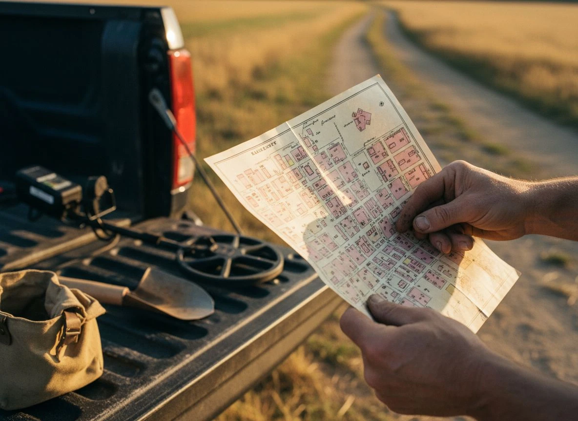
You’ve found your Sanborn map for metal detecting and translated the address. Now you need to see where that 1905 blacksmith shop sits today. Is it under a building? A parking lot? An empty field? This is where research becomes action.
The low-tech method for Sanborn maps metal detecting uses clear, physical layers. Print a large, clear version of your Sanborn sheet. Print a modern satellite view of the same area at the same scale (this takes some trial and error). Place the Sanborn printout over the satellite printout on a light table or against a bright window. Align permanent landmarks that haven’t changed: major street intersections, river bends, or old churches. You can now trace the old property lines onto the modern map.
The high-tech, game-changing method for Sanborn maps metal detecting is digital georeferencing. This sounds complex, but free tools like MapWarper make it easy. You upload your Sanborn map image. Then you tell the software where key points (like street corners) are on the historical map. You do this by clicking the corresponding spots on a modern map layer. The software “warps” the old map to align with the new one. The tutorial from UC Berkeley’s Archaeological Research Facility details this process. Once aligned, you can create a transparent overlay. You’ll see the 1910 boarding house footprint sitting directly atop the modern vacant lot you’ve driven past a hundred times.
This is how Tom and I found the streetcar stop. The 1912 map showed the track running along what is now the highway’s southbound lane. The stop and shops were in the “yard” to the east. Overlaying it showed that “yard” was now the wide, grassy median. The modern road had been built over the tracks, leaving the activity area untouched beside it.
What to Do When the Map Doesn’t Exist for Sanborn Maps Metal Detecting (The “Sanborn Gap”)
Not every town was mapped by Sanborn for metal detecting. This is especially true for small rural communities. Don’t panic. The Sanborn company had competitors. Look for fire insurance maps from Perris & Browne, Hexamer, or Bromley. Their maps are similar in detail. Also, don’t overlook bird’s-eye view maps from the 1870s-1900s or plat maps held by county clerks. These can show property boundaries, ownership, and locations of mills or schools. If you’re hunting rural areas, learning the 5 visual clues to old homestead sites becomes even more critical.
The key is to cross-reference. Use every source you can find to build a consensus about what was where. A location mentioned in a county history book, shown on a plat map, and visible in an old photo is a triple-verified site. This holds true even without a Sanborn. For truly forgotten sites, consider using LiDAR metal detecting to see the hidden landscape.
Essential Sanborn Maps Metal Detecting Tips for Productive Hunts
- Start with the Index Sheet. Always.
- Yellow = Wood, Pink/Red = Brick. Decode the materials to guess at the types of finds.
- Chase the Business Districts. Look for clusters of shops, streetcar stops, and theaters on the maps. Foot traffic = lost items.
- Beware the Renumbering. Assume the address has changed. Use city directories to track it.
- Overlay, Don’t Guess. Use digital tools or physical tracing to pinpoint the old footprint.
- Look for the “Trash Zones.” On the maps, look for alleys behind businesses, outhouses, and the edges of gathering spaces. These were the accidental drop zones.
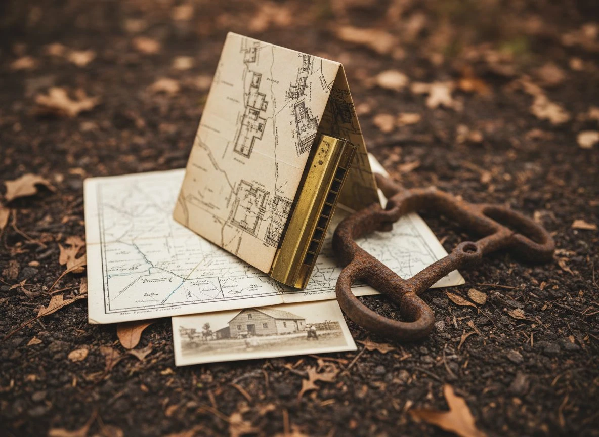
That Barber dime and brass token are now in a display case on my desk. They sit right next to the folded copy of that 1912 Sanborn map. They’re a daily reminder. The best detector you can buy isn’t a piece of technology you swing—it’s the knowledge of where to swing it. These Sanborn maps for metal detecting are that knowledge, crystallized. They turn hearsay into coordinates and guesses into grid patterns. Sure, it takes hours in front of a computer instead of out in the field. But I’ll take a morning of research that leads to a Seated Liberty quarter. I prefer that over a full day of aimlessly digging pull-tabs. Even Tom agrees with me on that now. Just remember, once you’re on site, proper technique is key. For instance, if you’re searching a creek bed near an old crossing, you’ll want to master the creek metal detecting setup. This will ensure the best results.

My name is Paul and I am the founder of Detector For Metal, a dedicated resource for metal detecting enthusiasts seeking to uncover historical treasures and connect with the past using the latest technology. As a stay-at-home dad and family man, I’ve found metal detecting to be the perfect hobby that combines family adventure with historical learnings for the whole family.
As a father, I’m deeply committed to passing on this hobby to the next generation of detectorists, starting with my own children. I share advice on everything from metal detecting with kids to exploring the top 10 metal detecting sites you never thought about. My methodical approach to the hobby goes beyond the thrill of discovery—it’s about creating family traditions while preserving history and sharing the stories of those who came before us.