Last weekend, I watched a guy spend six hours at the local park. Six hours! Swinging his $800 detector back and forth like he was mowing grass. Know what he found? Three bottle caps and a rusty nail.
Made me think about my first year detecting. Same story. Different park.
I was convinced the problem was my equipment. Saved up for months to buy a “better” detector. Guess what? Still found garbage. The detector wasn’t the problem. I was looking in all the wrong places.
That changed when I met Frank at a detecting club meeting. Gruff old guy, probably 70, who’d been doing this since before I was born. He looked at my handful of clad coins and shook his head.
“Son, you’re hunting where everyone else hunts. That’s your first mistake.”
Turns out, successful detecting isn’t about having the best equipment. It’s about understanding where people used to be. Not where they are now. Where they were 50, 100, even 200 years ago.
Ah-Ha Moment #1: People drop stuff where people gather.
Always have. Always will. But you need to think historically, not geographically.
That conversation completely changed how I approach this hobby. Want to know what Frank taught me?
The Historical Foundation: Why America’s Past Is Your Roadmap
Frank pulled out his phone and showed me something that blew my mind. A time-lapse of American population density from 1790 to 2010. Looked like a disease spreading from the East Coast westward.
“See how it moves?” he said. “That’s not random. That’s predictable human movement.”
Every dark spot on those early maps represents thousands of people living, working, and inevitably losing stuff. Coins. Jewelry. Personal items that are still buried today.
Key Takeaway: The 1790-2010 population maps reveal exactly where artifacts are concentrated across America.
Dark areas = people. People = dropped items. It’s that simple.
But here’s what really opened my eyes. Frank showed me an 1850 map of Manhattan. Guess what New York City looked like back then? Farms. Just farms. Neat little rectangular plots where families grew food.
Think about that for a second. Before Wall Street, there were actual walls around actual farms. Before skyscrapers, people were pulling weeds and feeding chickens. And losing wedding rings. And dropping coins.
Ah-Ha Moment #2: Every single place in America started as farmland.
Every single one. Cities, suburbs, shopping malls – all built over places where people lived and worked for generations.
This isn’t just East Coast stuff either. Chicago? Farmland. Los Angeles? Ranches and farms. Even Las Vegas started as agricultural land before anyone dreamed of casinos.
Transportation Changes Everything

“You drive to work every day, right?” Frank asked me. “Takes you what, 20 minutes?”
In 1850, that same trip would have taken three hours by horse and carriage. If the weather was good.
People couldn’t just hop in their car and go wherever they wanted. They were stuck. They had to plan every trip. They gathered at specific places out of necessity.
Train stations. Canal locks. Ferry crossings. Stage coach stops.
Key Takeaway: Slow transportation created predictable gathering points that concentrated human activity for decades.
Those gathering points? Still there. Usually buried under modern development, but still there.
I found my best seated quarter – 1853 – at what used to be a stage coach stop. Now it’s just a Sunoco station on Route 9. But for 40 years in the 1800s, travelers stopped there every single day to rest their horses and grab a meal.
Ah-Ha Moment #3: Modern roads often follow historical transportation routes.
When they pave over old dirt roads, they create a time capsule of artifacts sealed beneath the asphalt.
Research Arsenal: Tools That Separate Winners from Wishful Thinkers

Most detectorists do “research” by driving around looking for places that feel historical. That’s not research. That’s guessing.
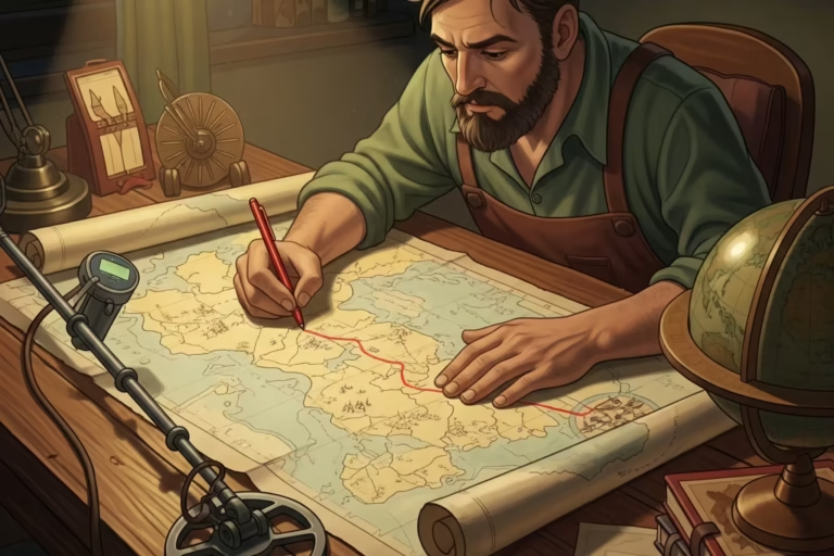
Real research starts with historicaerials.com. If you’ve never used this site, stop reading right now and go check it out. Seriously. I’ll wait.
Pretty incredible, right?
Historic Aerials: Your X-Ray Vision Into the Past
This site lets you overlay old maps on current satellite images. You can see exactly where towns used to be. Where roads ran. Where people lived.
I spent four hours on that site last Tuesday night. Found eight potential detecting spots within 15 minutes of my house. Spots I’ve driven past hundreds of times without noticing.
Key Takeaway: Historicaerials.com reveals productive detecting sites that are invisible to casual observation.
Here’s a perfect example. There’s a Walmart near my house. Looks like it was always there, right? Wrong. The 1903 map shows it was built right on top of a four-way intersection. Four roads came together there. People stopped. Traded. Socialized.
And dropped stuff.
I haven’t gotten permission to detect that parking lot yet. But I will.
Ah-Ha Moment #4: Historic aerials shows you what your eyes can’t see.
That empty field or modern building might have been a bustling community center 100 years ago. Historic aerials shows you what your eyes can’t see.
LiDAR Technology: Seeing Through Time

This technology uses laser pulses to map terrain features invisible to the naked eye. Sounds complicated, but it’s actually pretty simple to use.
Most state geological surveys have LiDAR data available for free online. You just need to learn how to read it.
The key principle? Nature doesn’t create straight lines. Humans do.
When you see squares, rectangles, or perfectly straight lines in LiDAR imagery, you’re looking at human activity. Old foundations. Property boundaries. Forgotten roads.
I found an entire homestead this way last month. Middle of what looks like empty woods. But LiDAR showed the foundation outline clear as day. Pulled six large cents from around that old foundation.
Key Takeaway: LiDAR technology can identify 200-year-old homesites that are completely invisible from ground level.
Historical Maps: Reading the Clues

I collect old maps now. County atlases from the 1800s. Town plat maps. Even old road maps. The Sanborn Maps are a great resource for this.
Each one tells a story about where people were and how they moved around.
Look for specific words on old maps:
- “Ford” – river crossing points (not the car company)
- “Ferry Point” – boat landing areas
- “Turnpike” – toll roads with heavy traffic
- “Inn” – traveler stopping points
Ah-Ha Moment #5: Map symbols reveal concentrated human activity points.
I have an 1847 map showing three ferry crossings that haven’t existed for over 100 years. But the land is still there. And so are the artifacts people dropped getting on and off those boats.
The Producer List: 15 Site Types That Actually Work
After 12 years of detecting, I’ve learned that certain site types consistently produce better finds than others. Here’s my list, ranked by productivity.
Permission-Based Gold Mines
1. Private Farms and Historical Estates
This is the holy grail of detecting. Private land that hasn’t been hunted.
Most detectorists are too scared to knock on doors. I get it. Rejection sucks. But here’s the thing – about 60% of landowners say yes if you approach them respectfully.
My best finds have all come from private property. That 1793 large cent? Private farm. The 1834 half dollar? Estate property.
Key Takeaway: Most productive sites require permission, but most detectorists won’t ask for it.
2. Construction Sites on Historical Roads

Modern roads follow old routes. When construction crews tear up asphalt, they expose decades of history.
I follow road construction projects obsessively now. Talk to the foreman. Explain what you’re doing. About half the time, they’ll let you detect before they repave.
My best road find? 1857 flying eagle cent, six inches under Route 202. Been sealed under asphalt for probably 80 years.
3. Stage Coach Routes and Historical Inns
Buildings with “Inn” in their original names often date to the stagecoach era. These places hosted travelers for decades.
The Riverside Inn near my house has been there since 1798. The current owner let me detect the side yard. Found a Spanish real and two large cents in one afternoon.
Key Takeaway: Historical inns concentrated traveler activity and valuable drops for generations.
4. Ferry Points and River Crossings

Before bridges, people crossed rivers by ferry. These locations saw constant traffic.
People handling luggage, money, and personal belongings while getting on and off boats. Think about how much stuff got dropped.
I found a 1776 Connecticut copper at an old ferry landing on the Connecticut River. The ferry hasn’t operated since 1895, but the landing area is still accessible.
Public Access Producers
5. Parks and Recreation Areas

Yeah, they’re hunted hard. But people keep dropping stuff there every single day.
The trick is going deeper and slower than other detectorists. Most guys hunt parks too fast, looking for easy surface finds.
Ah-Ha Moment #6: The best park finds are deeper and masked by iron. Most detectorists give up before reaching the good stuff.
Central Park in the city? I’ve pulled eight silver coins from there over the years. Everyone thinks it’s completely hunted out. It’s not.
6. Public Schools Built on Historical Land
Schools are often built on former farmland or estates. The detecting can be incredible if you time it right.
My elementary school is built on what used to be a dairy farm. Found a 1909 Indian head penny there last year. Probably fell out of a farmer’s pocket in 1910.
Just be smart about it. After hours only. Stay away from playgrounds. Be respectful.
7. Beaches and Swimming Areas
Ocean beaches get all the attention, but lakes and swimming holes are often better.
When people swim, their hands shrink from the cold water. Rings slip right off. Plus, swimming activities turn pockets inside out.
Key Takeaway: Swimming areas offer year-round potential because people continue using them and losing items.
Hit these spots right after busy summer weekends. Or during drought years when water levels drop and expose normally underwater areas.
Want to learn about DetectorForMetal’s best choice for beach detecting?
8. Urban Curb Strips and Small Grassy Areas
Most detectorists want big, comfortable spaces. But some of my best finds have come from tiny strips of grass between sidewalks and streets.
People used to picnic in these areas back when neighborhoods were less dense. Family gatherings. Community events.
Found a 1876 seated dime in a curb strip that was maybe four feet wide. Most people would walk right past that spot.
9. Sledding Hills and Recreation Slopes
This is seasonal detecting that most people never consider.
When people fall while sledding, stuff flies out of pockets. Gloves come off and rings fall out. Keys get lost in the snow.
Hit these spots right after the snow melts. You’re collecting an entire winter’s worth of losses all at once.
Found a 14k gold wedding band at our local sledding hill two years ago. Owner had lost it in January. I found it in March.
10. Woods Near Water Sources

Throughout history, people have gathered near reliable water sources. Springs. Streams. Natural wells.
These areas often contain surprisingly shallow historical artifacts. Organic debris in woods doesn’t bury items as deeply as agricultural soil.
Ah-Ha Moment #7: People always gathered near water. Always. These natural meeting points concentrated human activity for centuries.
My oldest coin – a 1722 wood’s Hibernia halfpenny – came from deep woods near a natural spring. Probably dropped by someone getting water 300 years ago.
Specialized High-Value Opportunities
11. Old Fairgrounds and Town Commons

Every community had designated spaces for fairs, markets, and civic events. Many of these locations have been developed over, but research can reveal their historical locations.
Town commons served as community centers for generations. People gathered there for celebrations, markets, and public meetings.
12. Civil War and Military Sites

This requires serious research, but the historical significance makes it worthwhile.
Focus on troop movement routes and temporary camp locations rather than major battlefields (which are usually protected).
Supply lines. River crossings used by armies. Overnight camping areas.
Key Takeaway: Military activities scattered artifacts across landscapes in predictable patterns based on troop movements and supply needs.
13. Homestead Act Areas

The Homestead Act of 1862 required a $10 fee to claim land. Settlers heading west often carried gold coins for this purpose.
Areas along western migration routes offer opportunities for finding these specific coins plus other pioneer-era artifacts.
The Oregon Trail. Mormon Trail. California Trail. All crossed multiple states and left scattered artifacts along their routes.
14. Underwater Recovery Sites
Rivers and lakes that have historical significance often contain artifacts deposited over many decades.
Equipment is expensive and specialized, but the potential is enormous. Items lost in water are often perfectly preserved.
Tried this once in a local lake that was a popular swimming spot in the 1920s. Found three gold rings in two hours. Definitely want to get back into underwater detecting.
15. Natural Gold Deposit Areas

Western states contain geological formations where gold nuggets can still be found with modern high-frequency detectors.
This requires specialized equipment and knowledge of geological surveys, but can yield extremely valuable finds.
Ah-Ha Moment #8: Modern detector technology can find gold nuggets that historical prospecting methods missed.
Regional Strategy: Playing to Your Geographic Advantages
East Coast: Historical Density Advantage
Colonial settlement. Revolutionary War sites. Established trade routes dating back 400 years.
The East Coast has obvious advantages for historical artifacts. But honestly, I’m tired of East Coast detectorists acting like they have a monopoly on good finds.
Key Takeaway: Longer settlement history creates more artifact layers, but every region has unique historical advantages.
Midwest: Hidden Ancient Potential
The Old Copper Culture artifacts in Wisconsin, Minnesota, and Michigan are incredible. We’re talking about worked metal that’s thousands of years old.
Plus, major pioneer trails cut right through the Midwest. Oregon Trail. Mormon Trail. California Trail.
Think about those wagon trains. Families carrying everything they owned across the country. How much stuff got lost along the way?
Key Takeaway: Plains states contain some of the oldest worked metal artifacts in North America.
Western States: Specialization Opportunities

Gold Rush history. Mining camps. Boom towns that appeared and disappeared within decades.
Most of those boom towns are ghost towns now. But the artifacts are still there. Coins. Jewelry. Tools. Equipment.
Desert areas also offer meteorite hunting opportunities. Arizona and New Mexico have geological stability that preserves meteorites for thousands of years.
Advanced Tactical Approaches
Understanding Site Logic
This is where you separate yourself from casual detectorists. Don’t just look for sites. Understand WHY people gathered in specific places.
Water sources were everything before indoor plumbing. High ground provided defense and visibility. River bends offered shelter from wind.
Key Takeaway: Geographic advantages created predictable human settlement patterns that concentrate artifacts in logical locations.
When I research a potential site, I ask myself: Why would people have chosen this specific spot? What practical advantages did it offer?
Usually, there’s a logical reason. Fresh water. Good drainage. Transportation access. Defensive position.
Understanding that logic helps you predict where within a site the best artifacts will be located.
Multi-Source Research Integration
Don’t rely on just one research method. Combine multiple sources to build complete site profiles.
Historical maps + LiDAR imagery + local historical society records + newspaper archives = comprehensive site intelligence.
Key Takeaway: Multiple research sources reveal productive sites that single sources miss.
Local historical societies often have information that’s not available anywhere else. Family stories. Community memories. Old photographs.
I found my best permission by talking to a historical society member who mentioned an old farmstead that had been abandoned since the 1930s. Owner’s family still lived nearby and was happy to let me detect there.
Timing and Environmental Factors
Environmental conditions can dramatically affect site access and productivity.
Drought years are golden for detecting. Low water levels expose areas that are normally underwater. Construction season opens up development sites. Winter freezing can preserve artifacts that would otherwise deteriorate.
Ah-Ha Moment #9: Environmental timing can expose normally inaccessible sites and concentrate artifacts in accessible areas.
Agricultural cycles matter too. Newly plowed fields bring deeper artifacts to the surface. But growing seasons may restrict access.
Implementation Strategy: From Research to Results
Getting Started Systematically
Stop hunting randomly. Start researching systematically.
Key Takeaway: Research first, detect second. This approach produces better results than random site selection.
Pick one research tool – I recommend historicaerials.com – and spend a weekend afternoon learning to use it effectively.
Identify five potential sites within reasonable driving distance. Research each one thoroughly before visiting.
Common Failure Points

Most detecting failures come from insufficient research, not poor equipment or technique.
Rushed site selection. Inadequate permission requests. Poor landowner relationships. Legal compliance issues.
Key Takeaway: Most detecting failures result from inadequate preparation rather than poor detecting skills.
I used to make all these mistakes. Spent years detecting marginal sites because I didn’t know how to find better ones.
Building Long-term Success
This hobby is about relationships as much as research.
Join local historical societies. Get to know construction foremen. Build relationships with farmers and property owners.
These relationships create more detecting opportunities than any equipment purchase or research technique.
Key Takeaway: Long-term success comes from building networks of people who can provide access to productive sites.
The Perspective Transformation
After 12 years of detecting, I’ve realized something important. This hobby isn’t really about finding treasure. It’s about connecting with history.
That 1793 large cent I found? Someone earned that coin. Carried it in their pocket. Maybe used it to buy groceries for their family. Then lost it one day while working in their field.
Every artifact connects you to a real person who lived a real life in the same place you’re standing. That connection to history is what keeps me detecting after all these years.
Final Ah-Ha Moment: Every artifact tells the story of a real person’s life. Understanding that transforms detecting from treasure hunting into historical preservation.
Start with one site. Do thorough research. Get proper permission. Take your time detecting it.
The artifacts are out there. You just need to know where to look.
And now you do.

My name is Paul and I am the founder of Detector For Metal, a dedicated resource for metal detecting enthusiasts seeking to uncover historical treasures and connect with the past using the latest technology. As a stay-at-home dad and family man, I’ve found metal detecting to be the perfect hobby that combines family adventure with historical learnings for the whole family.
As a father, I’m deeply committed to passing on this hobby to the next generation of detectorists, starting with my own children. I share advice on everything from metal detecting with kids to exploring the top 10 metal detecting sites you never thought about. My methodical approach to the hobby goes beyond the thrill of discovery—it’s about creating family traditions while preserving history and sharing the stories of those who came before us.

