Table of Contents
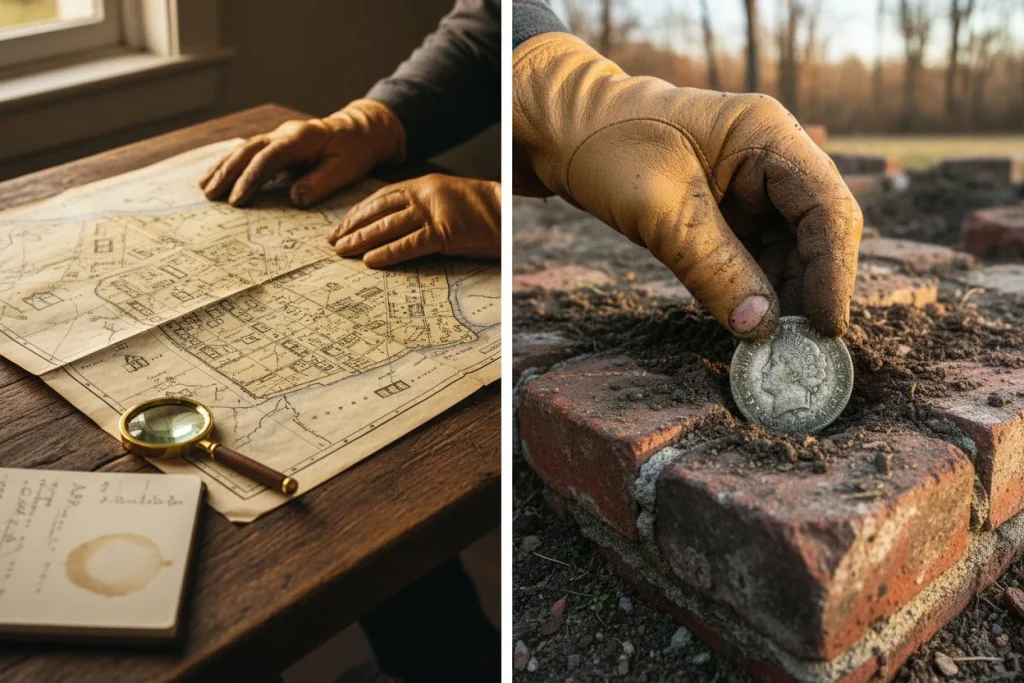
My buddy Mike stopped by last spring. He saw my kitchen table buried under old maps and legal documents and just shook his head. “Looking for buried treasure or trying to pass the bar exam?” he asked. Two weeks later, we were in a field I’d found by tracing a property line on a 1904 deed. It led back to a creek mentioned in an original land grant. My Minelab Equinox 900 chirped, and I pulled up a 1912 Barber quarter and a tarnished silver locket. The locket was empty, but the story was right in my research folder. The land belonged to a family that hosted church picnics. Mike stopped calling it luck after that.
A lot of detectorists get fixated on gear—the coil, the settings, the tones. Don’t get me wrong, I love my Equinox. But the biggest upgrade to your success isn’t a new machine. It’s learning to navigate the world of public records and deeds. This is how you stop hunting randomly and start hunting intentionally. It’s the difference between hoping for a find and knowing you’re standing where history happened. This research is the key to getting metal detecting permission on private land.
I’ll be honest. This part of the hobby means more screen time than field time at first. It feels like detective work with a frustrating filing system. But when it clicks, it’s a different kind of rush. You use a 150-year-old property description to find a spot no one’s detected in decades. This guide is the manual I wish I’d had. It breaks down the tools, the lingo, and the steps to turn records into permissions.

Start Your Hunt in Public Records: The County Clerk
We all dream of that historic, open pasture. But finding out who owns it is step one. Your county government’s website is the modern gateway. Look for the “County Clerk,” “Recorder of Deeds,” “Auditor,” or “Tax Assessor” office. Their online portals are treasure maps in disguise.
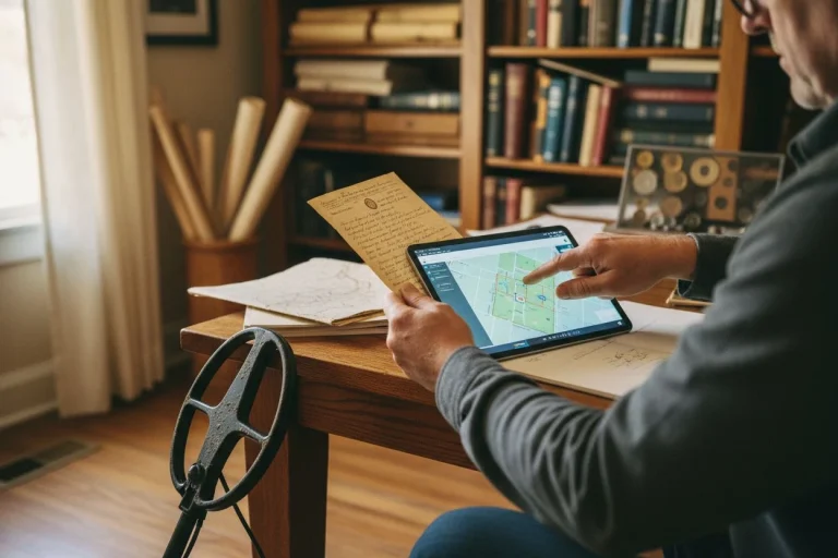
These sites host GIS (Geographic Information System) maps. A GIS map is a layered, digital map of the whole county. You can zoom in on any parcel of land. With a click, you get key info: the current owner’s name and address, the parcel ID number, the property’s size, and its value. This is your foundation. Knowing how to spot these clues on a map is crucial. That’s why I also rely on 5 Visual Clues to Old Homestead Sites. Historic Aerials and similar sites let you compare modern parcels with old aerial photos. You can see where barns, outbuildings, or old roads used to be.

My first big success with this was a small woodlot near an old railroad. The modern GIS map showed it as a vacant, overgrown parcel. I cross-referenced the address in the county’s online property transfer records. I found it had been sold just two years prior. A new owner often means a more open mind. I sent a letter, mentioned the parcel number and my interest in railroad history, and got a yes.
How to Read Old Property Deeds: A Guide to Metes and Bounds

Most online guides stop short. They tell you to find the deed, but not how to read it. Once you have a parcel ID or owner name, you can search for the actual deeds. You’re looking for the legal description of the property. In older areas, this is often in “metes and bounds.”
This is the archaic, poetic, and sometimes maddening language of old surveys. It describes property boundaries from a starting point. It uses compass directions and distances in chains and links (old units; a chain is 66 feet). The magic is in the monuments—the fixed objects they mention. A modern description uses lot numbers. A 19th-century one talks about “the old blazed oak tree,” “the large stone pile,” or “the center of the creek.”
I spent an entire afternoon once locating the “point of beginning” for an 1872 homestead. The deed referenced a “witness stone” that was “2 chains south of the wagon ford on Mill Creek.” I used a modern topo map and distance conversion to approximate the spot. When I walked the creek bank, I found a single, large, moss-covered stone that looked out of place. That stone was my anchor. From there, the deed’s directions led me to a gentle rise. Later maps showed it held the homestead’s kitchen garden. My first signal there was a thick, cast-iron button.
This process of aligning old text with the modern landscape is deep, geospatial research. It’s the mental equivalent of the Ultimate Guide to Deep Metal Detecting. It’s about uncovering what’s hidden beneath the surface of the obvious. Tools like the ARCHI UK database are built for this. They integrate old maps and archaeological records. ARCHI focuses on the UK, but it shows the power of this method. It turns written history into a precise, mappable location.
Trace Property History: Following the Chain of Title
Finding the current deed is good. Tracing the chain of title back through time is where you find the real gold—the historical context. Each time a property sells, a new deed is filed. By working backward, you can trace land to its original transfer from the government (a “land patent”).
This is where you discover a quiet field was once part of “The Thompson Dairy Farm” in 1890. These aren’t just names; they’re clues. A dairy farm means potential lost cow tags and a homesite. An orchard suggests worker activity or lost coins. This is how you find the Household Relics – Everyday Items Lost to Time. These ordinary objects tell the intimate story of daily life.
County clerk sites often have digitized deed indexes. You can search by seller or buyer. It can be tedious. You might scroll through microfilm or scanned images with terrible handwriting (thank god for digital zoom). But one connection can open a vault. I once traced a suburban backyard to a 1920s deed. It called it “the former site of the Riverside Picnic Grove.” Bingo. That backyard gave me more early 1900s wheat pennies and bottle caps than any park I’ve hunted.
What Can You Find at a Historical Society?
County records give you the who and the when. Your local historical society gives you the what and the why. This is where your research comes to life. Once you have a family name from an old deed, take it to the historical society.
Ask for:

- Old City Directories: Find where the family lived and worked.
- Census Records: See family members, their ages, and origins.
- Photo Collections: You might find a picture of the very barn on your site.
- Local History Books: These often have sketches of early families.
This isn’t just nice context. It tells you where to swing your coil. Knowing the Thompsons had three sons means a higher chance of lost toys near the house. Learning the property hosted a church picnic tells you to focus on shady, flat areas. This research helps you identify the kind of relics you might be looking for. The Metal Detecting Lost & Found: Fashion Items, Tools & Stories guide details many such items.
As noted in resources like Focus Speed, libraries hold irreplaceable microfilm and directories. I once found a 1931 classified ad in a local paper: “Lost at the Thompson farm picnic, a child’s silver locket.” I never found that specific locket, but it confirmed my research was dead-on. The soil there should hold early 1900s personal items.
How to Get Permission Using Your Research

Now you’re not just some random person with a metal detector. You’re the one who took time to learn about their land. This changes everything when it comes to getting metal detecting permission.
When you contact the owner, lead with respect and knowledge. Always use mail or go in person. Never trespass.
“Hello Mr. Smith, my name is Paul Edgerton. I’ve been researching the local history around your property on Old Mill Road. My records show your land was part of the original Johnson Orchards in the early 1900s. I’m a responsible detectorist and historian. I’d be honored to get your permission to carefully scan some open areas. My goal is to recover and preserve bits of local history. I’m happy to show you anything I find and leave the land exactly as I found it.”
This approach frames you as a researcher, not a treasure hunter. It shows you’ve done homework, which builds trust. Resources on landowner agreements recommend this. It demonstrates you’re serious and professional. While you’re focused on history, this methodical approach is also a cornerstone for anyone looking into making money. The How To Make Money Metal Detecting In 2026: Ultimate Guide shows how. It’s built on respect and sustainable access.
When Deed Research Doesn’t Lead to Treasure
Let’s not sugarcoat it. For every success, there’s a dead end. I once spent three weeks tracing a chain of title for a farm. A 1940s article said it hosted huge political rallies. I got permission and gridded the field excitedly. I found… almost nothing. Just some modern fence staples and a tractor part. The ground was probably deeply plowed, scattering any old finds. It was a crushing reminder. Research increases your odds, but doesn’t guarantee a payoff. Sometimes the history is just gone.
Other times, records are incomplete. They might have burned in a courthouse fire or never existed for small parcels. That’s okay. The process itself—the hunt through archives—is a big part of the fun for people like me. (My wife says it satisfies my inner detective, who’s persistent and obsessed with old handwriting.)
The research landscape is also changing. As one advanced guide points out, documents like Environmental Impact Reports can have detailed archaeological assessments. They can pinpoint old foundations or dump sites.
So, grab your laptop before your detector. Bookmark your county’s deed portal. Introduce yourself at the local historical society. The signals you dig up will be sweeter when you know the story behind the soil. You’re not just finding lost objects. You’re reclaiming lost stories, one researched permission at a time. Mastering the art of getting metal detecting permission starts with this research.

My name is Paul and I am the founder of Detector For Metal, a dedicated resource for metal detecting enthusiasts seeking to uncover historical treasures and connect with the past using the latest technology. As a stay-at-home dad and family man, I’ve found metal detecting to be the perfect hobby that combines family adventure with historical learnings for the whole family.
As a father, I’m deeply committed to passing on this hobby to the next generation of detectorists, starting with my own children. I share advice on everything from metal detecting with kids to exploring the top 10 metal detecting sites you never thought about. My methodical approach to the hobby goes beyond the thrill of discovery—it’s about creating family traditions while preserving history and sharing the stories of those who came before us.