Table of Contents

You’ve studied the old maps. You’ve knocked on doors for permission. You’ve hunted the local parks so much your coil knows every pull-tab. I’ve been there. That feeling that every good spot is “hunted out” is totally normal. But what if the best site—the one dripping with history—isn’t on any of your maps? What if it’s hidden in plain sight, only visible from a view you never use: straight down.
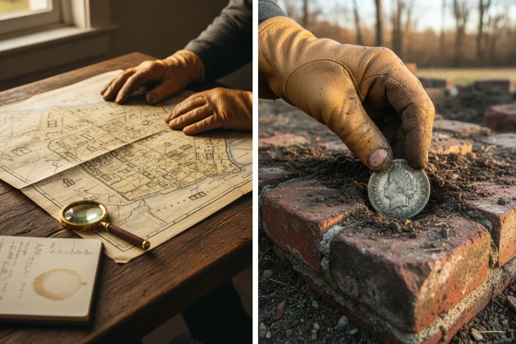
My first big research win came from looking up. I was following a tip about a forgotten train stop near Auburn, something an 87-year-old former conductor mentioned. The modern spot was just a wide place in the road. But when I lined up a 1950s aerial photo with an old Sanborn fire insurance map, I saw it: the ghostly outline of a platform and a siding, long since plowed under. That invisible spot gave me over 30 Indian Head pennies and my first seated Liberty dime. The aerial photo was the key.
This isn’t just a lucky break. The Aerial Archaeology Research Group states that more archaeological features have been found worldwide through aerial photography than by any other survey method. That stat isn’t just for pros. It’s a powerful clue for us. I’ll show you the practical system I use—no plane or PhD needed—to analyze free aerial photos and find overlooked public sites. We’re going beyond the obvious.
Think of this as the next level after basic site research. If you’re new to this, start with my complete guide on Secret Site Analysis to Find More Metal Detecting Site Research. Then, let’s learn to see what everyone else misses.
Is Your Metal Detector Missing Hidden Sites?
Here’s the truth: Your fancy detector only tells you what’s under your coil right now. A historical aerial photo shows you what used to be there and where the good stuff probably settled. It reveals old paths, property lines, and trash pits. It shows change, like a 1950s picnic grove now buried under a parking lot. These things are invisible from the ground. Think of aerial photos as the landscape’s cheat codes.
Let me be clear about one of my core beliefs: Research beats expensive gear every time. You can swing a $1,500 detector over empty ground all day. Or, you can use a $250 starter machine at a site you found through research and pull history. The aerial photo is your best research tool.

From the ground, we miss the big picture. We see a flat, weedy field. Our detector only reads the dirt right under the coil. We might miss a subtle mound 20 yards away that marks a homestead foundation. The bird’s-eye view changes everything.
Modern tools like aerial LiDAR go even further. A 2026 Popular Archaeology report highlights how this laser tech sees through forest canopies. It reveals hidden earthworks, old roads, and building foundations. I’ve used it on county maps for wooded areas near old mining towns. A confusing brush pile from the ground becomes a clear map of tailings and camp outlines from above.
The advantage comes down to two things you can’t get from the street:
- Seeing Invisible Patterns: A faint, straight line in a modern park is nothing from the ground. On a 1940s aerial, it’s a forgotten footpath to a gone trolley stop—a natural spot where coins collect.
- Viewing Change Over Time: This is the real magic. Using the historical slider on Google Earth, I watched a great 1920s swimming hole get filled in and paved over for a supermarket in 1972. The edges of that old lot are still accessible. My detector wouldn’t have led me there. The timeline of photos did.
Your detector finds targets. Aerial photos find the places worth searching. Without that map, you’re just guessing.
Your Free Aerial Research Toolkit

Good news: You don’t need a pilot’s license or a big budget. The best intel is free. My system uses three tools: the everyday workhorse (Google Earth Pro), the government goldmine (county GIS), and the historical deep dive (university archives). Master these, and you’ll find sites hiding in plain sight.
I once spent a Saturday baking in a vacant field. An 1880s fair map had me convinced. After four hours and a few modern coins, I quit. On Monday, I checked my county’s GIS portal out of frustration. I found a 1962 aerial layer. That “vacant field” was a packed midway just 60 years ago. My detector wasn’t wrong. I was 50 yards off. The next weekend, I corrected my spot and found my first Barber dime. The lesson? My research wasn’t done until I checked the aerial record.
Using Google Earth Pro for Historical Layering
This free desktop app is your starting point. Its magic is the historical imagery slider. Watch a modern park revert through time. See the parking lot fade and the original 1950s picnic grove come back. I use it for a quick “timeline check” on any spot. The resolution varies, but for seeing big changes like filled-in ponds or old ball fields, it’s great. It’s the first tool I open.
Find Public Land with County GIS Portals
This is where you get serious. Most county property websites have a public GIS (Geographic Information System) portal. These often have super clear current photos. Sometimes they use providers like Nearmap, which offers sharp 3-inch resolution imagery covering 72% of the U.S. population. More importantly, they often have historical aerial layers from the 1930s-1990s. This is how I found that fairground outline.
For bigger areas, the USGS Earth Explorer is a federal treasure trove. You can download old topo maps and aerial scans. It’s a bit more technical, but it’s free. As a citizen, you can even help with projects like The National Map Corps. It’s a living resource. Bookmark your county’s GIS site now.
Uncover History with Local Archive Photos
For the oldest clues, you sometimes need to go offline. Local university map libraries or historical societies often have physical aerial photo sets from the 1920s-1940s. I’ve spent hours at UC Davis looking at Depression-era farm flyover photos, finding old homesteads now under suburbs.
Here’s the key pro tip: single photos hint, but comparison tells the story. As guides from Historic England stress, you need a wide range of images taken over many years to understand a site. A faint mark in a damp 1950s spring photo might vanish in a dry 1970s shot. By looking at different eras side-by-side, you see what’s really there. This turns a maybe into a definite target.
How to Analyze a Site Step by Step
Here’s the process: Don’t just look—analyze. A single photo is a snapshot. The story is in the changes between them. My workflow has four steps: pick a promising area, layer historical photos to see its life story, spot the oddities, and then zoom in to mark your search grid.
This is how you turn random scrolling into a real investigation. I use it for every new spot. The core idea, from Historic England, is that you need a “wide range of images… taken over many years” to read a landscape right. One photo can lie. A timeline tells the truth.
Step 1: Selecting Your Search Area
Don’t start by zooming in on one pixel. You’ll get lost. Begin with a bigger zone—a large park, a stretch of riverbank, or a town district. Your goal is to set a search perimeter based on logic:
- Historical Maps: An 1880 map shows a church in what’s now a wooded park. That’s your zone.
- Local Stories: Old-timers mention a “swimming hole” off Route 9. Mark that general area.
- Geography: An old ferry crossing or a spot where trails met. These were activity hubs.
Open your modern base map (Google Earth works) and draw a mental box around this zone. This is your canvas. The next steps show where inside this canvas to focus.
Step 2: Comparing Historical Map Layers
This is the heart of the method. You’re building a timeline to see how the land changed. For most U.S. sites, I target three key times:
- 1940s-1950s (Post-War): Often the oldest good aerials. Shows the land before suburbs and highways. Look for dirt roads and small farms.
- 1970s-1980s (Transition): Shows the mid-century boom. New houses appear, but you might see the last of older structures.
- Present Day (Baseline): What the site looks like now, hiding all the past.
The Workflow: In your county GIS or Google Earth Pro, stack these layers. Switch between them. Watch a modern lot become a 1950s baseball diamond. See an overgrown lot turn into a tidy homestead. This side-by-side look reveals the lost activity spots.
Step 3: Identifying Ground Anomalies
Now, play detective. Scan for clues that shout “people were here”:

- Faint Geometric Shapes: Squares, rectangles, or circles in old photos but gone today. These are building foundations or tank bases. A faint rectangle in a 1942 shot led me to a vanished CCC camp barracks.
- Soil & Grass Marks (Parch Marks): In dry weather, grass over shallow stone foundations browns faster, outlining structures. Look for sharp, straight lines in a field—nature doesn’t make those.
- Path Networks: Thin, wandering lines connecting points. These are old footpaths or animal trails. They lead to gathering spots. I found a bunch of Mercury dimes where three such paths met in an old field.
- Holes in Development: A patch in a 1970s neighborhood that’s still empty today. Why? It might be a filled-in pond or an old dump. I’ve had luck with these “gaps.”
Step 4: Pinpointing Your Digging Hotspot
You found an anomaly—a ghost foundation from the 1950s. Now, get precise.
- Pin it: Drop a placemark on the center of the feature in your oldest, clearest photo.
- Reference it: Note its distance from a permanent landmark in all photos. “The foundation is 50 yards north of the big oak tree” or “150 feet west of the current bridge.”
- Create a Search Grid: Use the measurement tool to outline a 50×50 foot area around your pin. This is your first search zone.
- Ground-Truth: Use a handheld GPS or your phone’s map to walk to that exact grid. Your desktop coordinates should get you close.
Your Field Checklist:
- Historical map research defines your general Zone of Interest.
- At least three aerial eras compared (40s/50s, 70s/80s, Today).
- Anomaly identified (foundation, path, soil mark).
- Placemark pinned on oldest clear image.
- Location referenced to a permanent landmark.
- Search grid outlined and coordinates noted.
This system removes the guesswork. You’re not randomly covering 100 acres. You’re doing a focused dig on a 2,500-square-foot plot you know had people. The dirt and your detector will tell you the rest.
Reading the Landscape for Digging Clues

Look closer: You’re not just seeing a picture; you’re diagnosing the land. The best sites shout through subtle hints: lines of different grass, soil color patches, and low shadows. My best find came from a “ghost fence line” only visible in a 1972 photo. It led me to a cache of early 1900s coins.
Your analysis pays off here. You’ve layered the photos. Now, read them. Don’t just look for buildings—look for the land’s memory of them.
Start with vegetation. Look for straight lines or shapes made by different growth. These are “crop marks” or “parch marks.” As an Environmental Science guide explains, buried stone or compacted paths hold less water. This stunts plants above them. That’s a “negative” mark. Buried organic stuff in old trash pits holds more water, creating a line of lusher, greener grass. That’s a “positive” mark. I once saw a faint, straight, darker grass line across a soccer field in a spring photo. On the ground, it was invisible. My detector found a “ghost fence line” there, and along it, I dug up 14 Wheat pennies and three Barber dimes from the 1910s. The fence was gone, but its shadow remained.
Next, check soil color differences. After a light rain, spots that dry faster might have shallow rubble. A distinct dark patch in a field can mean a filled-in cellar.
Shadow and shape help at dawn or dusk. Historic England notes that oblique photos (taken at an angle, often in early morning) make small bumps easier to see. A tiny rise, invisible at noon, can cast a clear shadow at sunrise, showing a filled-in foundation or an old property line.
Finally, hunt for the “human imprint.” Nature is messy. People create order. Any sudden straight line, right angle, or perfect circle in a natural setting is a red flag. It could be a filled-in well, an old property line now treed, or the rectangle of a gone house. Your job is to see the ghost.
Finding Overlooked Modern Public Sites
When did you last find a new park? I don’t mean a new-build. I mean a public space that’s been there for decades, collecting drops, that just never hits your radar. We love 1800s homesteads, but some of the easiest, most productive spots aren’t in history books. They’re forgotten modern sites, and aerial analysis finds them.
These places are invisible because we’ve forgotten them, not because they’re gone. I mean the small 1970s subdivision park that’s now overgrown. The public pool filled in during the ‘90s. The fairground parking lot that turned to scrub. Even utility corridors or old landfill caps that are now public land.
You can think like an urban planner here. Companies like SkyFi use AI on satellite photos to track city growth for planning. We can use the same eye to find what’s missing or changed. Pull up a 1995 aerial next to a 2025 shot of your suburb. Look for places that were clearly parks, pools, or plazas that are now just blank, green space on the new map. That green space is your target.
My buddy Tom uses this for modern silver. His best site was a “pocket park” from a 1980s apartment complex. The complex was torn down, the land sat empty, and the little playground slab was buried under weeds. A 1992 aerial gave him the hint. He detected it and found over a dozen silver Roosevelt dimes and three class rings from the ‘80s and ‘90s. The site had maybe 15 years of use, but no one else ever thought to swing a coil there.
These spots don’t have arrowheads. They have modern jewelry, mid-1900s silver coins, and bits of recent community life. They fly under the radar because they aren’t “old.” But for a detectorist, that recent history is a goldmine—sometimes literally. Use your historical aerial layers to find the spaces that time forgot.
Your Ground-Truthing Checklist Before You Dig
The crucial part: Finding a target on a screen is easy. The real work—and your ethical duty—starts when you grab your gear. This is your checklist for moving from digital find to responsible hunting. It covers legal access, safety, and leaving the site better.
My firm belief is that ethical detecting is the only kind with a future. A site isn’t a “find” until you know you can hunt it legally, safely, and without wrecking history. I run through this list before I even load my car.
Securing Legal Permission and Access
Never assume a green spot on a map is public or open to detecting. First, verify.
- Check the Deed: Use your county’s online parcel viewer (the same GIS portal). Click the site to see the owner. If it’s private, you need clear permission. If it’s public land, find the specific park rules.
- Municipal Rules: Search the city or county website for “metal detecting ordinances.” Some parks allow it, some restrict it, some ban it. Not knowing isn’t an excuse.
- Ask Directly: For private land, talk to the owner. Be polite. Explain what you do, show a photo of a clean plug, and offer to share cool historical finds. My best permissions came from showing a picture of a neat plug next to a found coin.
Conducting a Site Safety Assessment
A great aerial spot can hide real dangers. Scout the site visually first, without your detector.
- Ground: Is it stable, or are there erosion risks or hidden holes? Can you get there without damaging the land?
- Structures: Are there crumbling buildings, old wells, or shaky fences? My buddy Tom always says, “No relic is worth the ER.”
- Modern Junk: Look for signs of dumping, broken glass, or chemical containers. An old filled-in pool site might have rebar.
Leaving a Site Better Than You Found It
This is where you prove detectorists are caretakers, not looters. Leave no trace.
- Your Gear: Use a sharp digger for a clean plug. Use a drop cloth for soil and a pinpointer to keep holes small. Restore every dig perfectly.
- Big Finds Protocol: If you find something that looks historically important (lots of artifacts together, structural remains), stop. Take photos in place, note the GPS spot, and call your local state archaeology office. They’d rather hear about a potential pioneer site than find it was looted.
- Pack Out All Trash: Take all trash, including your own. I bring a separate bag for modern junk I dig up. Leaving a site cleaner than you found it is the best way to support our hobby.
This process is like the verified model of The National Map Corps, where citizens check data for official USGS maps. We’re not just taking; we’re adding to a place’s story. The ghost fence line that gave me my Barber dimes is only special because the site was respected. The find is your reward for doing the right homework first.
Start Your Next Aerial Research Hunt Today
Here’s the takeaway: You now have a real system to find hot spots that other detectorists miss. The thrill isn’t just in the find—it’s in discovering the place itself and touching its story.
This method changes you. You go from hunting known spots to being the person who finds them. It proves that research beats gear. As the 2026 Popular Archaeology report shows, tools like aerial LiDAR are revealing entire lost sites. We’re using that same bird’s-eye logic for our hobby.
The real joy for me is the connection. Just a few Saturdays back, I used this exact workflow on a grassy, boring corner of a big park. Old aerials showed a bustling neighborhood tot-lot from the 1960s there, with a tiny wading pool—all erased. I took my kids. Watching them swing their pinpointer over where the sandbox was, then yelling when they found a 1972 Jefferson nickel and some vintage ‘Pogs,’ was priceless. That’s the point. It links us to a forgotten layer of everyday life.
You have the tools. The overlooked sites are waiting. Now that you know where to hunt, make sure you’re ready with the how. Check out our practical detector guides to sharpen your technique for whatever you uncover. Your next great hunt starts on your screen.

My name is Paul and I am the founder of Detector For Metal, a dedicated resource for metal detecting enthusiasts seeking to uncover historical treasures and connect with the past using the latest technology. As a stay-at-home dad and family man, I’ve found metal detecting to be the perfect hobby that combines family adventure with historical learnings for the whole family.
As a father, I’m deeply committed to passing on this hobby to the next generation of detectorists, starting with my own children. I share advice on everything from metal detecting with kids to exploring the top 10 metal detecting sites you never thought about. My methodical approach to the hobby goes beyond the thrill of discovery—it’s about creating family traditions while preserving history and sharing the stories of those who came before us.