Table of Contents
For us California detectorists, the dream is wide-open land hiding forgotten history. The reality? A tangled web of rules meant to protect that very same history. Figuring it out is the ultimate test of our hobby. Success in metal detecting in California public land hinges on knowing where you can go and how to respect it.
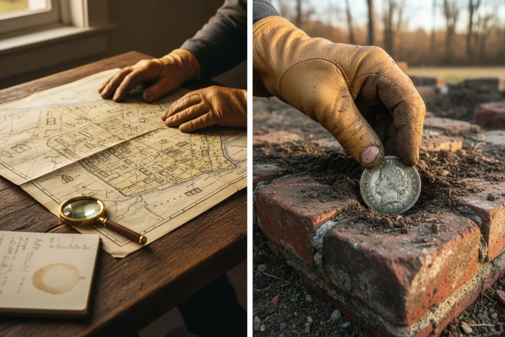
I remember driving out to a remote BLM stretch in the Eastern Sierra for the first time. My research—a mix of old topo maps and a faded photo from the county archive—hinted at a late-1800s sheepherder camp. After a long hike, my Equinox 900 finally buzzed over a slight depression. A few inches down, I pulled out a 1970s Lincoln cent. Bummer. But right next to it, the edge of a thick, sun-purpled glass bottle poked out. That was the paradox in a nutshell. A modern coin sat on a century-old bottle dump, a protected cultural site. I took the coin. I carefully reburied the bottle and hunted the edges the rest of the day. The freedom to explore 15 million acres of BLM land is incredible. Exploring another 20 million of National Forest is a privilege. But it comes with a non-negotiable duty. We must preserve the outdoor museum we’re walking through.
We all share that dream. I’m here to tell you you can reach it—legally and ethically. This guide is your map, your rulebook, and your modern toolbox for exploring California’s overlooked grounds with confidence. Let’s get you out there.
The Laws for Metal Detecting in California Public Land Explained
Here’s the single most important rule for federal land. Prospecting for minerals is generally allowed. Digging for historical artifacts is strictly forbidden. Getting this wrong isn’t just a mistake. It’s a federal crime. My buddy Tom still talks about the new guy at our club meeting years ago. He was proudly showing off photos of a pristine 1890s trade token. He’d “rescued” it from a BLM hillside. The room went silent. An older member had to pull him aside. He gently explained the guy had just confessed to breaking the Archaeological Resources Protection Act (ARPA). That token wasn’t treasure. It was a protected piece of history. He was lucky he didn’t get fined.
The law draws a bright line at 100 years. On BLM and National Forest land, coins, bottles, tools, or any other human-made items over 100 years old are protected. You can’t collect them. Period. The U.S. Forest Service is clear. Using a detector to hunt for “treasure trove” or historical artifacts needs a Special Use Permit. Hobbyists won’t get one. Searching for recent, dropped items is considered casual fun. This includes modern coins or jewelry. It is allowed in most areas.
This isn’t bureaucratic nitpicking. That 100-year-old button has context. Its location tells a story about who lived or worked there. Removing it destroys that story forever. So, we play by the rules. The table below is your cheat sheet to stay on the right side of the line.
| Prospecting (For Gold/Minerals) | Relic Hunting (For Artifacts) | |
|---|---|---|
| Legal Basis | Governed by the 1872 Mining Law. It’s considered a legitimate casual activity. | Governed by the Archaeological Resources Protection Act (ARPA). |
| Permit Needed? | Usually not, for casual, low-impact use. A “Notice of Intent” might be needed for major ground disturbance. | YES. A Special Use Permit is required. These aren’t given to hobbyist collectors. |
| Key Restriction | You can’t dig on an active mining claim without the claimant’s permission. | The 100-Year Rule: Any artifact over 100 years old is protected. You can’t take it. |
The bottom line is simple. On federal land, we’re modern-day prospectors and casual recreationists, not archaeologists. We fill our holes. We pack out trash. If we ever accidentally uncover something genuinely old, we admire it. We take a photo. We rebury it carefully and note the spot for the land manager. This is how we save the history and our future access. For a deeper dive on getting permission anywhere in the state, my Essential California Permission Guide has you covered.
Must-Have Digital Tools for Public Land Hunts

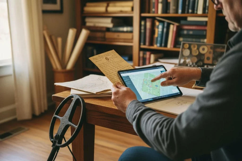
Forget random wandering. The modern secret to good ground isn’t just a sharp eye. It’s a layered digital map. By stacking a modern boundary map, an active claim map, and a historical overlay, you can find productive, legal spots from your kitchen table. Here’s my exact three-step process.
Start with a Reliable GPS App
First, you need to know you’re actually on public land. I use OnX Hunt (the Backcountry version works too) or Gaia GPS as my base layer. These apps show clear, GPS-accurate lines for BLM, National Forest, and private land.
Last spring, I was scouting a ridge in the Sierra foothills for a weekend trip. On a regular topo map, it just looked like empty wilderness. But pulling up OnX showed a jagged checkerboard. Long fingers of BLM land were mixed with private parcels. The public access wasn’t where I thought. Without this digital baseline, I could’ve easily wandered onto someone’s property. That would have been illegal. These apps are your first, non-negotiable filter.
How to Check Active Mining Claims
Just because land is public doesn’t mean it’s open. This is the step most people skip. It’s critical. With over 20,000 active mining claims in California, your dream spot might already have someone’s name on it.
You must check the BLM’s Mineral & Land Records System (MLRS). Here’s my quick routine:

- I go to the BLM’s official MLRS website.
- I use the map tool to zoom into my area (that same ridge from OnX).
- I turn on the “Active Claims” layer.
A few clicks showed me two active placer claims. They covered the most promising-looking gullies on my map. That doesn’t mean I can’t go there. But it does mean I can’t dig or disturb material. For a detectorist, that’s a deal-breaker. I panned the map over. I found a big, claim-free parcel right next to it. That became my new target.
Find Sites with Historical Maps
Now for the fun part: the “why.” If the land is public and not claimed, why would someone have been there 100+ years ago? This is where you add the history layer.
I’ll hunt down a georeferenced 1900s mining claim map. I find them in university archives. I also look for scanned old USGS topo maps. For my Sierra foothills spot, I found a great 1905 mining district map. I saved it to my tablet. Standing in the field with OnX open, I could literally see where the old “Eagle Mine” shaft symbol lined up with a subtle feature on my GPS. I wasn’t hunting blind. I was checking a specific, historical point of activity.
For towns or travel routes, I use the tricks in our Sanborn map guide to find where old buildings stood. The goal isn’t to dig artifacts. It’s to understand where people lost things. That activity zone, especially its edges, is where modern drops can legally be found. Pre-1924 coins (remember the 100-year rule!) might also be there.
The magic happens when all three layers line up. You need a public parcel. It must be clear of active claims. There must be a historical reason for people to have been there. That’s your overlooked spot.
Where to Metal Detect on Public Lands
Think of federal land as a giant, open-access park. It has specific rooms marked “Do Not Enter.” Your detector is your ticket in. Knowing which doors are locked is critical. The rules aren’t there to ruin your fun. They’re to protect history and wilderness you can’t replace. Here’s your clear list of green lights and absolute stop signs.
Green Light Zones (Proceed with Respect)
- General BLM Land: Outside of the restricted areas below, huge stretches of BLM land are open for casual detecting for modern stuff. If your map says it’s BLM and MLRS shows no active claim, you’re probably good.
- National Forest Recreation Sites: Developed spots like official campgrounds, picnic areas, swimming holes, and trailheads are usually okay. These places get heavy modern traffic and have low historical sensitivity. Hunting for recent drops is fine here.
Absolute No-Go Zones (Don’t Even Bring Your Detector)
- Archaeological & Historical Sites: Any area with signs of past human activity is closed. This means old cabins, sawmills, graves, trails, mining camps, or ranches. If you see old foundations, pottery pieces, or stacked stone, back away.
- Designated Wilderness Areas: These are set aside to stay wild. Mechanical transport is banned to keep the primitive feel. This includes metal detectors.
- National Monuments & Landmarks: These are marked for their big historical or natural value. Detecting is almost always forbidden.
- State Parks with Specific Bans: Some state parks ban even having a metal detector on-site. Marshall Gold Discovery State Historic Park is one example. Always check the specific rules for the park.
When in doubt, the local ranger station is your best friend. A five-minute stop can clear up boundaries. It can save you a big fine.
Essential Gear for Responsible Detecting on Public Land
Public land detecting isn’t just about what you find. It’s about how you leave it. The right gear and mindset let you hunt effectively. They also protect the land for everyone after you. It’s the difference between being a visitor and being a steward.
What to Pack for a Detecting Trip

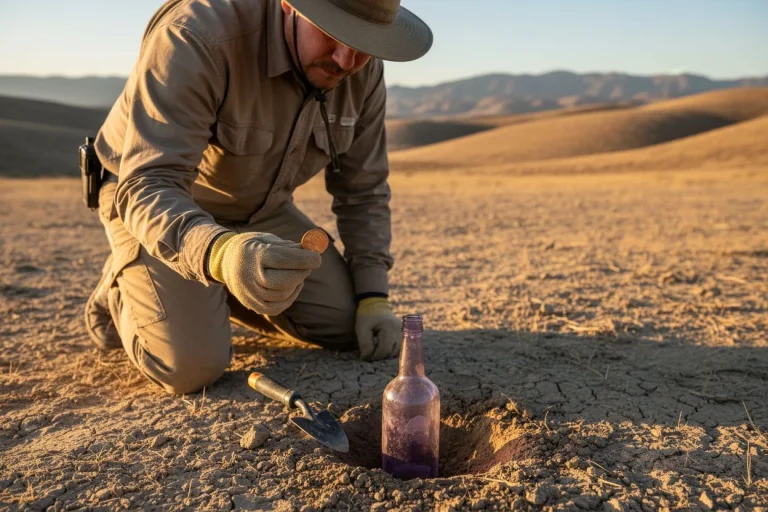
Forget complex setups. On remote BLM or Forest Service land, reliability is king. My truck kit always has a prospector’s pick. The point pries and the flat end scrapes. I also carry a stainless steel gravel scoop for streams and a strong, sharp digger like a Lesche for our famous hardpack. Most important? A GPS unit or your phone with an offline map app (like OnX or Gaia). Cell service is a fantasy out there. Marking your truck or a good gulch is a safety and efficiency must. For a full breakdown of every tool, I’ve detailed my whole 8 Must-Have Tools for the Field Detectorist.
How to Recover Finds Responsibly
How you dig matters as much as what you find. On dry, hard soil, I use a drop cloth. An old towel or a dedicated digging cloth catches all the dirt. This lets me pour every bit back into the hole. It leaves no trace. For a clean plug in hardpack with no grass, cut a deep, narrow “U” or “V” shape. Hinge it back and get your target. Then, fit the plug back in like a puzzle piece. Tamp it down firm. If you uncover anything that looks old and man-made, stop. That’s potential cultural material. Rebury it gently and move on. You’re protecting history, not collecting it.
Key Safety Tips for Remote Areas
This isn’t a park hunt. My buddy Tom and I once misjudged the heat on a Sierra foothills scan. We went through our 3-liter water supply by noon. We had to cut the day short, thirsty and annoyed. Always pack more water than you think you need. Tell someone your plan and check-in time. Weather changes fast in the mountains. A rain shell is light insurance. And in California, fire safety is non-negotiable. Before you go, check for current fire restrictions with the local ranger district. During high-risk times, spark-producing activities can be banned. Yes, even your steel digger hitting a rock. It’s not just a rule. It’s our shared job to prevent the next wildfire.
Case Study: Detecting Tahoe National Forest
Last season, my buddy Tom and I put this guide’s steps into action. We planned a day hunt in the Tahoe National Forest. It was a perfect test. It involved methodical prep, on-the-ground choices, and the humble reward that proves you’re doing it right.
Our day started at my kitchen table, not the trailhead. I pulled up the BLM’s Mineral & Land Records System (MLRS). I needed to make sure the parcel we’d picked on OnX Hunt wasn’t under an active mining claim. We saved the boundary on our offline maps. Crucially, I called the local ranger district. The person I talked to confirmed detecting was fine in the general forest area. But they repeated the absolute rule from the Tahoe National Forest’s own guidance. If we saw any sign of an old structure or site, we had to turn around. That sheet was our rulebook for the day.

We parked in a wide, designated pull-off. We geared up and started swinging in a scattered pine grove. Within twenty minutes, Tom pointed out a faint, rectangular depression. He also saw some scattered, hand-cut logs. They were the collapsed remains of a historic cabin. It was exactly the kind of “Do Not Enter” door the rules warn about. We backed away and marked a waypoint to avoid it. It was a small but vital act of stewardship.
The finds themselves weren’t glamorous. I dug a few .22 casings and a modern tent stake. Tom found some shredded aluminum can slaw. But then, in the loose soil near an old stump, I got a crisp, high-toned signal. Eight inches down was a single, dark 1940s Wheat penny. It wasn’t gold. But it was a century-old mystery solved. A coin was lost by a hunter, fisherman, or forester long before we were born. It was a perfect, legal find under the 100-year rule. It was proof the process works, even when the treasure is small.
BLM and Forest Detecting FAQs Answered
The rules can feel overwhelming. But they boil down to a few key ideas. Here are straight answers to the questions I hear most at club meetings.
Do I need a permit to metal detect in a National Forest? For casual detecting aimed at recent coins or lost jewelry, no permit is needed on most Forest Service land. Think post-1960s items. This is considered low-impact fun. But, if your goal is specifically to search for historical artifacts or a defined “treasure trove,” that needs a Special Use Permit. Hobbyists rarely get one. Always check with the local ranger district first. Some areas have specific closures.
What if I find an old coin or artifact? If you think an item is over 100 years old, the law is clear. Leave it where it is. On federal land, coins and artifacts past that century mark are protected under ARPA. Take photos and GPS notes. Re-bury it gently. Think about reporting the general location to the land manager. It’s not a find you can keep. But you’ve helped save a piece of history.
Can I detect on an active mining claim? Technically, yes. You can be on the surface of an active claim with a detector. However, you cannot dig or remove any material without the claim holder’s clear permission. In practice, most good gold-bearing claims are actively worked or watched closely. It’s better to use the BLM’s MLRS. Find unclaimed areas for peaceful hunting.
What’s the best detector for this kind of ground? You need a versatile, multi-frequency machine. It must handle hot, mineralized soil. I’ve had great luck with my Minelab Equinox in the Sierras. For a full breakdown of models for different budgets and terrains, I’ve put together a detailed guide on choosing the right metal detector.
The Real Reward of Responsible Detecting

The paradox of our hobby is clear. Its greatest freedom is roaming vast public lands. That freedom comes with its greatest duty: preservation. The real treasure isn’t just what you take home. It’s the history you leave intact for the next person. It’s the example you set for the community.
That 100-year line isn’t a bureaucratic hurdle. It’s the threshold of a story that belongs to everyone. I’m far from perfect. But this idea hit home last fall. I took my kids back to a cleared-out picnic grove. We’d detected there years before. My daughter swung her little Garrett Ace. She got a signal and dug up a modern scout badge from the 1990s. We laughed, imagining the kid who lost it. Then I showed them the spot. Years earlier, I’d not dug a scatter of 19th-century nails. I’d stopped and walked away. One spot held two layers of time. One we could keep. One we protected.
The best find is a site left better than you found it. Its full history is still waiting. The next detectorist might be your kid, a club member, or a stranger you’ll never meet. Our shared ground isn’t just dirt and rules. It’s a collective project in stewardship. Let’s pass it on with more history than we found.
Want my personal playbook for researching historical sites? I share my best methods—like using old fire insurance maps and LiDAR—in my weekly newsletter. Join here for free.

My name is Paul and I am the founder of Detector For Metal, a dedicated resource for metal detecting enthusiasts seeking to uncover historical treasures and connect with the past using the latest technology. As a stay-at-home dad and family man, I’ve found metal detecting to be the perfect hobby that combines family adventure with historical learnings for the whole family.
As a father, I’m deeply committed to passing on this hobby to the next generation of detectorists, starting with my own children. I share advice on everything from metal detecting with kids to exploring the top 10 metal detecting sites you never thought about. My methodical approach to the hobby goes beyond the thrill of discovery—it’s about creating family traditions while preserving history and sharing the stories of those who came before us.