Table of Contents
What if the best metal detecting site in your city isn’t a park, but a parking lot? I don’t mean today’s lot. I mean the one from 1912, right where you’re standing. That simple shift—from what is to what was—is the biggest upgrade you can make to urban detecting. The key to that shift is a set of historical documents called Sanborn Fire Insurance Maps. For detectorists, using Sanborn maps for metal detecting is the ultimate research method.
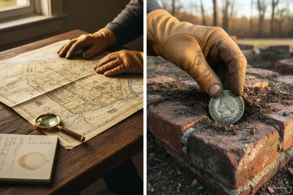
I learned this the hard way. For years, I hunted parks and schools like everyone else. My finds were predictable: modern coins and recent drops. Then, an old-timer at a historical society told me about a forgotten train stop near Auburn. The spot looked like nothing: a gravel pull-out next to some old railroad ties. My first signal there was a deep, solid tone. It turned out to be a brass baggage tag from the 1890s. That “nothing” spot yielded over 30 Indian Head pennies. Why? Because I knew to look there, not at the shiny new playground across the street. My kitchen table has been covered in maps ever since. That experience taught me the power of using Sanborn maps for metal detecting.
Most of us swing over where people are now. The real treasure is where they were—where they lived, worked, played, and lost things a century ago. That’s where Sanborn maps come in. Made from 1867 to 1977 for fire insurance agents, these incredibly detailed maps show the built environment of over 12,000 American towns. They document every house, store, stable, and outhouse. For them, it’s an insurance record. For us, it’s a target-rich blueprint of the past.
This guide will turn that blueprint into a digging plan. I’ll walk you through finding your city’s maps online for free. We’ll decode their colorful symbols into a detectorist’s hit list. Finally, I’ll show you how to turn a 1905 saloon location into a modern GPS coordinate. Let’s turn your screen into a time machine.
Unlocking History: A Guide to Using Sanborn Maps for Metal Detecting

Think of them as an X-ray of your city’s past. From 1867 to 1977, the Sanborn Map Company made detailed, large-scale maps for fire insurance underwriters. Their job was to document anything that affected fire risk. That meant building materials, the location of every home and business, and even hydrant and alarm box placements. For them, it was about risk. For us, it’s a target list. That’s why using Sanborn maps for metal detecting is so powerful.
Here’s the cool part: These maps weren’t made for detectorists, but they’re perfect for us. A modern map shows roads and parks. A Sanborn map shows the centers of human activity from a century ago. It shows precisely where people lived, worked, socialized, and inevitably, lost things.
Where today’s satellite view shows an empty lot, a Sanborn map might reveal a row of wooden houses, a blacksmith’s shop, or a stable. It turns anonymous modern space into a specific, historical landscape of opportunity. My first major coin spill came from a spot marked “S” (Store) on a 1905 sheet. The front stoop where customers fumbled for change was long gone. But the coins were still there, eight inches down. The map didn’t just tell me what used to be there. It told me exactly where to stand.
How to Find Sanborn Maps for Your Town
Start with the Library of Congress’s free digital collection. It’s your single biggest source, with over 660,000 maps for more than 12,000 towns. My first try was a mess of slow microfilm readers. Now, I can pull up a 1912 map of downtown Sacramento in under two minutes. When you’re using Sanborn maps for metal detecting, this is your first and most crucial step.
Search the Library of Congress Collection
Go to the Library of Congress Sanborn Map Collection. Use the “Browse Maps by State” dropdown, then pick your city or town. The key is to look for multiple years. A city might have maps from 1884, 1892, 1900, and 1912. Download every set you find. Comparing years shows how a neighborhood changed. You can see where old front yards and alleys used to be.
Check State and Local Historical Archives
The LOC is the motherlode, but don’t ignore state archives. For example, Texas has the great TexShare program, with digitized maps for 436 cities. Try a quick search like “[Your State] historical society Sanborn maps.” You’ll often find archives with higher-resolution scans than the LOC has.
Choosing the Best Map File Format
On the LOC site, you’ll get download options. Always grab the “PDF” or “High-Resolution Image” (usually a TIFF). The PDFs are high-quality enough to zoom in on street names. I create a computer folder named “Sanborn_[CityName]” with subfolders for each year. Being organized here saves huge headaches later when you’re cross-referencing.
Interpreting Sanborn Map Symbols for Detectorists
You’ve got your maps. Now you’re staring at a detailed, multicolored sheet. It looks more like an architectural plan than a treasure guide. Don’t panic. The genius of Sanborn maps is their consistent, coded language. Here’s how to translate it into a plan for where to swing your coil. Interpreting these symbols is the core skill of using Sanborn maps for metal detecting.
The colors and symbols told an agent about fire risk. For us, they tell a story about human activity. A yellow wooden house and a red brick bank create very different detecting scenarios.

The Color Code: Reading Building Materials
The maps use a simple color wash to show what a building was made of. This clues us into its purpose and what might be left behind.
- Yellow (Wood): This is the most common color for houses, sheds, and small shops. Wooden structures are goldmines. They were often built on piers or had crawl spaces. When torn down, debris—and the contents of collapsed floors—was often just pushed into the basement and covered. A yellow footprint is prime territory for early 1900s artifacts.
- Red (Brick): Means brick or stone construction. Think banks, bigger stores, factories, and nicer homes. These sites often have compacted ash and cinder fill around their foundations. Detecting here can yield higher-value coins and lost items from commerce, like tokens.
- Blue (Stone or Iron): Less common. It denotes stone foundations or iron-front buildings. These were often major commercial structures. Focus on entryways, loading docks, and adjacent vacant lots.
Detectorist’s Translation Table: From Abbreviation to Action
This is where we move from history to hunting. Don’t just note the abbreviation—think about what people did there.
| Map Symbol | What It Means | The Detectorist’s Translation (Where & What to Find) |
|---|---|---|
| D (Dwelling) | A house or apartment building. | Front Yard/Porch: The #1 spot for coin spills (fumbling for keys). Backyard & Alley: Trash pits (ash, bottles, toys), clothesline drops. Side Yard: Often the location of the water pump, a hub of activity. |
| S (Store) | A retail business. | Front Step/Entryway: High traffic for lost coins and jewelry. Adjacent Boardwalk: Gaps between planks swallowed countless items. Check the curb line out front. |
| Saloon | A bar or tavern. | Prime territory. Look for coin spills, bartender tokens, watch fobs. Back alley for broken bottle dumps and items lost from… spirited departures. |
| Stable | Horse stable. | Packed-dirt yard: Great for deep, clean signals. Find horse hardware (bridle rosettes, harness bells), blacksmithing slag, and coins lost by stable hands. |
| F.H. (Fire Hydrant) | Public water access. | A social spot. People paused here, chatted, and dug for coins. A classic location for early 20th-century coins in a small area. |
| A.B. (Alarm Box) | Fire alarm telegraph. | Similar logic to the hydrant—a defined, important street corner where people stopped. |
Finally, look for the small black dots or circles around buildings. These mark pipelines, cisterns, and wells. When a property was updated, these were often just filled in. A filled-in well is a literal time capsule. It usually contains a single layer of household trash from the exact year it was sealed. Finding one on the map is like getting a written invitation. This is a key target when using Sanborn maps for metal detecting.
The map is no longer a mystery. It’s a checklist. Your next hunt isn’t at “the park.” It’s at the footprint of the 1908 wooden Dwelling at 5th and Maple. Focus on the backyard ash pile and the side-yard pump. That’s how you turn history into a signal.
Solving Old Street Names and Address Changes
This is where most research fails. You can perfectly read a 1905 map. But if you don’t account for renamed streets and renumbered addresses, you’ll dig in the wrong spot. The #1 reason historical site pins land on modern freeways is ignoring this puzzle. This step is critical when using Sanborn maps for metal detecting.
I learned this the hard way. I once drove to a perfect 1905 address for a corner saloon. It was a freeway on-ramp. Don’t be me.
Cities changed constantly. A classic example is New Orleans. In the 1890s, the entire city changed its street numbering system. An 1885 address points to a completely different modern lot. This happened everywhere.
Do this mini-workflow before you leave home:
- Note the Map Year: This is your baseline. You’re looking for changes after this date.
- Search for Changes: Try “[Your City] street name changes [decade].” For example, “Cleveland street name changes 1920s.” Local historical society sites are gold for this.
- Check a Historical City Directory: These often list both old and new addresses during transition years. Many are free on sites like Internet Archive.
Pause here. Seriously, do this step now. It’s the difference between a good hunt and a story about concrete. Once you know “Third Street” became “MLK Blvd.” in 1965, your 1912 map snaps into place with your GPS.
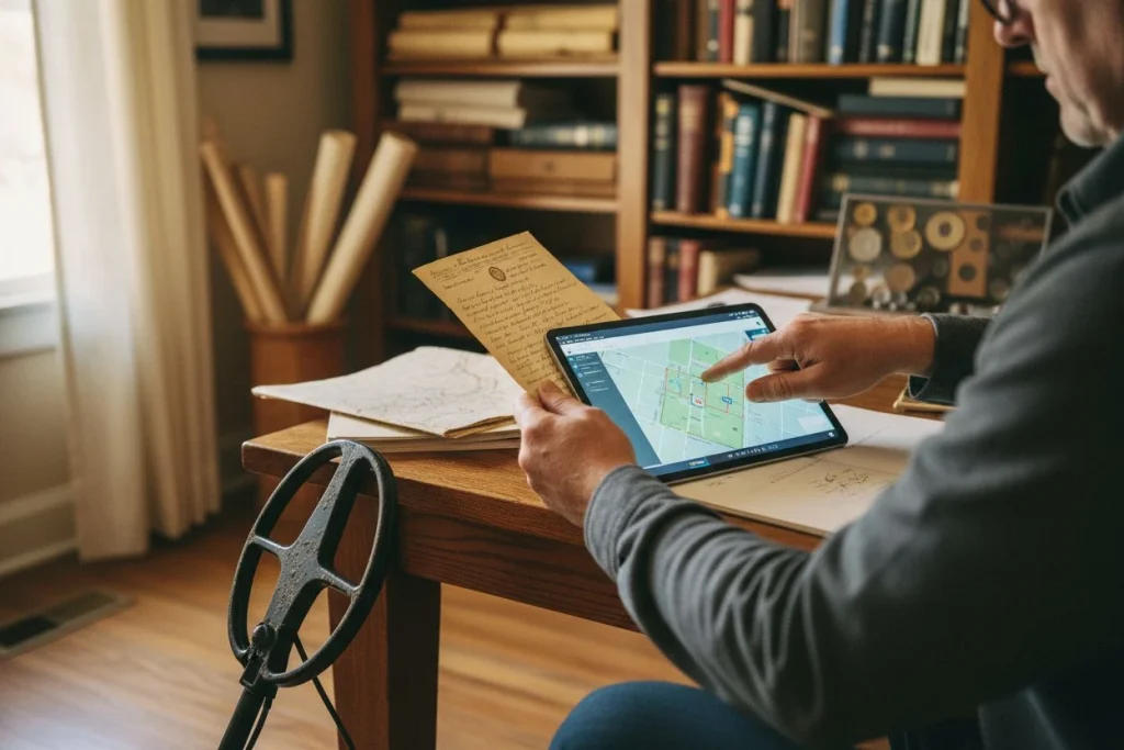
Plotting Historic Maps: A Key Step for Using Sanborn Maps for Metal Detecting

This is where the magic happens. We’re aligning a century-old map with today’s world. Grab your Sanborn sheet and open Google Earth. Time to place your first historical pin. Mastering this is the final step in using Sanborn maps for metal detecting.
Using an Anchor Point to Align Maps
First, find an “anchor point.” This is a structure on the old map that still exists. I always start with churches, courthouses, or major civic buildings. They’re the least likely to be torn down. Find it on your Sanborn sheet, then locate the same building in Google Earth’s satellite view. In Google Earth Pro (the free desktop version), drop a pin on that building. This is your control point. Now find a second permanent feature—maybe a street corner or another old building. Drop a second pin. You’ve now got a two-point reference to align past and present.
Overlaying Maps in Google Earth Pro
This is the digital method I use most. In Google Earth Pro, click “Add Image Overlay” (the little grid icon with a plus). A window pops up. Click “Browse” and upload your scanned Sanborn map. A semi-transparent version of your map will now float on screen. Use your anchor points to move, rotate, and scale the overlay. Grab the green crosshair to move it. Use the corners to scale. The goal is to stretch the old map so your church pin sits directly over the modern church. It takes some fiddling. When it snaps into place, you’re looking at a ghost image of 1912 over today. Use the transparency slider to see the old lots under modern streets.
The Simple Measuring and Walking Technique
No computer? No problem. My buddy Tom still uses this. On the Sanborn map, use the printed scale (usually 50 or 100 feet to the inch). Measure the distance from your anchor point (like the corner of an old church) to your target (like the back porch of a razed house). Convert that map distance to real feet. Go to the actual site. Stand at the anchor point and use a handheld GPS or a measuring wheel to walk off that exact distance and direction. You’ll be standing right on top of your target’s historical location. It’s less precise for large areas, but for a specific backyard, it works great.
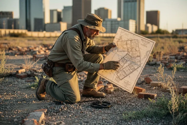
Best Places for Metal Detecting Using Sanborn Maps
My buddy Tom, the “race guy” in our club, didn’t find his first grandstand footing by wandering a field. He found it on a 1928 Sanborn sheet. The map showed the exact outline of the wooden bleachers for a forgotten dirt track. We gridded that ghostly footprint for a weekend. We found over two dozen early wheat pennies, a Mercury dime, and a brass admission token. The map gave us a precision target. This is the payoff. Once you can read the map, you need to know what to look for. Here’s your hit list for using Sanborn maps for metal detecting.
Prime Residential Targets:

- Outhouses & Privies (often marked): This is the #1 feature for any detectorist. They were meticulously recorded. They weren’t just bathrooms; they were the household trash pit for a century. I’ve found Indian Head pennies, perfume bottles, and straight razors in their backfilled remains.
- Cisterns (marked as circles, often “C”): These were underground water tanks. When decommissioned, they became catch-alls. Small coins and jewelry lost while drawing water settled at the bottom.
- Coal Chutes & Sheds: High-traffic areas. Coins fell from pockets during unloading. The dark, dusty environment meant losses went unnoticed.
Commercial & Social Hotspots:
- Saloon/Bar Entrances & Back Patios: Check the front steps and any rear outdoor space. This is where coins fell and where old bottle caps accumulated.
- General Store (S) Frontage: The boardwalk or porch area out front is a coin spill magnet. Think of people pulling out change.
- Stable Yards & Blacksmith Shops: Horseshoe nails and tools are common, but so are coins dropped by stable hands. Look for the open areas on the map.
The Structural Goldmines:
- Building Perimeters: Especially for wood-frame structures (colored yellow). As porches were enclosed, items fell between floorboards and settled just outside the foundation line.
- Footpaths & Alleyways: The informal shortcuts between buildings, often shown as faint dotted lines, were high-traffic corridors.
The genius of Sanborns is that you stop seeing a “neighborhood.” You start seeing a diagram of human activity. You’re not just looking for an old house. You’re looking for its outhouse, its coal delivery spot, and its front walkway. The map turns history into a literal X marks the spot.
Legal and Ethical Guidelines for Map Research
Researching a site is half the battle. Accessing it legally is the other. A Sanborn map shows where history happened, but it doesn’t give you the right to dig there. Understanding current ownership and local laws is what separates a responsible detectorist from a trespasser. This is just as important as knowing how to start using Sanborn maps for metal detecting.
This is the hill I’ll die on: a historical map is a research tool, not a permission slip. Pinpointing the 1895 location of Smith’s Saloon doesn’t mean you can dig in the modern apartment complex there. Your next step is always to check the current status of the land. Use your county’s online assessor map to find the owner. Look up municipal codes for metal detecting. Many cities ban detecting in public parks. Violating that can mean fines and a bad name for all of us.
The absolute, non-negotiable rule is to get explicit permission from the landowner. Always. And when you dig, you must fill your holes perfectly. No one should be able to tell you were there. I carry a small towel to place the sod on, and I pack the soil back in layers.
Why be this strict? Because we’re not looters. We’re the first point of contact with history. Our goal is to preserve and learn, not just extract. A found relic connects us to the past. Leaving a scarred landscape destroys that connection for everyone else. Do the paperwork. Talk to the right people. You’ll stay out of trouble and help ensure this hobby has a future.
Start Reading Your City’s Layered History

We’ve done the tour. We found the maps, decoded their symbols, solved the address puzzle, and overlaid them on modern views. We also covered the ethics. This process turns a random city block into a targeted historical site. That connection is waiting all over your town, and using Sanborn maps for metal detecting is the best way to find it.
The payoff is real. Last weekend, my youngest kid was swinging his pinpointer over a spot our 1915 map marked as a backyard clothesline. He got a signal and pulled up a perfect, swirling blue glass marble. His face lit up. That marble was lost by a kid over a century ago. A map led us right to it.
That connection is waiting all over your town. The history is in the ground. Your detector finds it, but your research tells you where to swing. Now you know how to start. Pull up those Sanborns. Find your first target. Get permission. Go listen to what the past left for you, using Sanborn maps for metal detecting.

My name is Paul and I am the founder of Detector For Metal, a dedicated resource for metal detecting enthusiasts seeking to uncover historical treasures and connect with the past using the latest technology. As a stay-at-home dad and family man, I’ve found metal detecting to be the perfect hobby that combines family adventure with historical learnings for the whole family.
As a father, I’m deeply committed to passing on this hobby to the next generation of detectorists, starting with my own children. I share advice on everything from metal detecting with kids to exploring the top 10 metal detecting sites you never thought about. My methodical approach to the hobby goes beyond the thrill of discovery—it’s about creating family traditions while preserving history and sharing the stories of those who came before us.